IMAGES TAKEN NEAR TO
Chester Road, TARPORLEY, CW6 0ST
Introduction
This page details the photographs taken nearby to Chester Road, CW6 0ST by members of the Geograph project.
The Geograph project started in 2005 with the aim of publishing, organising and preserving representative images for every square kilometre of Great Britain, Ireland and the Isle of Man.

There are currently over 7.5m images from over14,400 individuals and you can help contribute to the project by visiting https://www.geograph.org.uk
Image Map
Images are licensed for reuse under creativecommons.org/licenses/by-sa/2.0
Notes
- Clicking on the map will re-center to the selected point.
- The higher the marker number, the further away the image location is from the centre of the postcode.
Image Listing (9 Images Found)
Images are licensed for reuse under creativecommons.org/licenses/by-sa/2.0
Image
Details
Distance
1
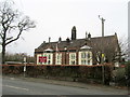
Delamere National School, 1846
Now re-branded as the Delamere C of E Academy.
Image: © John H Darch
Taken: 8 Mar 2019
0.02 miles
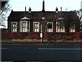
2
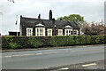
Delamere Church of England Primary Academy
School building dating from 1846. Grade II listed building (Historic England List Entry:1139158 https://historicengland.org.uk/listing/the-list/list-entry/1139158 ).
Image: © David Dixon
Taken: 8 May 2023
0.02 miles
3
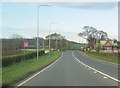
Stoney Lane junction from A556 west
Delamere school to the right
Image: © John Firth
Taken: 15 Apr 2012
0.02 miles
4
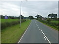
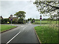
The A556 approach to Stoney Lane junction at Delamere
Image: © Raymond Knapman
Taken: 26 Sep 2013
0.02 miles
5
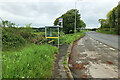
Delamere, Stoney Lane
The junction with the A556 (Chester Road)
Image: © David Dixon
Taken: 8 May 2023
0.02 miles
7
Delamere School
Looking north across the A556 to the school and nursery at delamere
Image: © Paul McLaughlin
Taken: 2 Jan 2006
0.06 miles
8
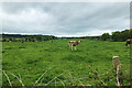
Cows in a field at Delamere
Cows grazing in a field next to Stoney Lane.
Image: © David Dixon
Taken: 8 May 2023
0.08 miles
9
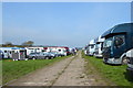
Kelsall Hill Horse Trials: lorry park
Image: © Jonathan Hutchins
Taken: 24 Apr 2015
0.22 miles