
IMAGES TAKEN NEAR TO
High Street, TARPORLEY, CW6 0AT
Introduction
This page details the photographs taken nearby to High Street, CW6 0AT by members of the Geograph project.
The Geograph project started in 2005 with the aim of publishing, organising and preserving representative images for every square kilometre of Great Britain, Ireland and the Isle of Man.

There are currently over 7.5m images from over14,400 individuals and you can help contribute to the project by visiting https://www.geograph.org.uk
Image Map
Images are licensed for reuse under creativecommons.org/licenses/by-sa/2.0
Notes
- Clicking on the map will re-center to the selected point.
- The higher the marker number, the further away the image location is from the centre of the postcode.
Image Listing (65 Images Found)
Images are licensed for reuse under creativecommons.org/licenses/by-sa/2.0
Image
Details
Distance
1
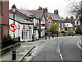
Tarporley, The High Street
Tarporley is a large (population 2,614 at the 2011 Census) picturesque village on the west of the Cheshire Plain. It is believed that the High Street was part of a Roman Road called the Via Devana which ran from Chester to Colchester and the Domesday entry indicates that Tarporley was a small agricultural settlement in Norman times (http://www.tarporley.org.uk/about/history/ History of Tarporley). The village developed during the eighteenth and nineteenth centuries as it was on the route used by many traders travelling by coach between London and Chester as well as those dealing in salt mined in nearby Nantwich; it is now bypassed by the A49 and A51 roads (http://www.tarporley.net/main/about.htm About Tarporley).
Image: © David Dixon
Taken: 11 Apr 2016
0.04 miles
2

Tarporley, The Chapel
On High Street; starting life as Baptist Chapel dated 1866, now Baptist and Methodist.
Image: © Mike Faherty
Taken: 4 Oct 2015
0.04 miles
3
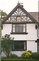
A gable of the Manor House, High Street, Tarporley
Decorative timber framing, with a colourful coat of arms. The inscription to the moulded bressumer reads "Ralph Done Esquyer, the Lorde of this place, was an eade to this buldying in ever case. John Wytter 1586”. The beam below the first floor window reads "Feneys quoth Jhon Newsome hathe kept hys promes just, In buldying of thys house in August, anno 1585." (From imagesofengland)
Image: © Humphrey Bolton
Taken: Unknown
0.05 miles
4
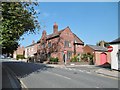
Tarporley, former police station
On High Street, bearing plaques "County Constabulary" and dated 1909; now residential.
Image: © Mike Faherty
Taken: 4 Oct 2015
0.06 miles
5

Tarporley old fire station and museum
Tarporley old fire station, Park Road, Tarporley, Cheshire, now used as a Fire Service Museum
Image: © Kevin Hale
Taken: 30 Oct 2007
0.06 miles
6
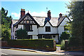
The Manor House, Tarporley
The Manor House is a Grade II timber-framed house dating from 1585.
Image: © Jeff Buck
Taken: 2 Aug 2018
0.07 miles
7
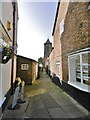
Tarporley, Church Lane
Cobbled path from High Street to St. Helen's (in the background). Properties include estate agent, beauty salon and barber's.
Image: © Mike Faherty
Taken: 4 Oct 2015
0.10 miles
8
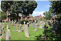
The Churchyard of St Helen's Church, Tarporley
St Helen's churchyard on the south side of the church.
Wikipedia https://en.wikipedia.org/wiki/St_Helen%27s_Church,_Tarporley
Image: © Jeff Buck
Taken: 2 Aug 2018
0.10 miles
9

Tarporley Church
St Helen's Church is medieval, but altered 1861-79 and a baptistery added in 1932.
Image: © Humphrey Bolton
Taken: Unknown
0.11 miles
10

Tarporley, St. Helen's
Parish church off High Street, dating from C15 and listed by English Heritage: http://www.imagesofengland.org.uk/Details/Default.aspx?id=57257&mode=adv
Image: © Mike Faherty
Taken: 4 Oct 2015
0.11 miles