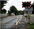
1
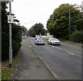
Modern houses on London Road, Nantwich
Image: © JThomas
Taken: 12 Nov 2016
0.07 miles
2
You're entering a Designated Public Place notice, London Road, Nantwich
The Crewe & Nantwich Borough Council notice on a lamppost states that if you continue to drink alcohol in this area when asked not to do so by a police officer, you are liable to a fine on conviction.
You may be arrested if you fail to surrender any intoxicating liquor to a police officer in this area.
Image: © Jaggery
Taken: 13 Oct 2016
0.09 miles
3
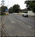
Parking space for long or slow vehicles, London Road, Nantwich
On the approach to Newcastle Level Crossing. Instructions http://www.geograph.org.uk/photo/5242395 for the drivers of large or slow vehicles are ahead.
Image: © Jaggery
Taken: 13 Oct 2016
0.09 miles
4
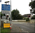
Instructions for the drivers of large or slow vehicles, London Road, Nantwich
On the approach to the Newcastle Level Crossing. http://www.geograph.org.uk/photo/5156743
A parking space http://www.geograph.org.uk/photo/5242397 for large or slow vehicles is behind the camera.
Image: © Jaggery
Taken: 13 Oct 2016
0.09 miles
5
Nantwich - Newcastle Road joins London Road
The curve marks the former junction between the two roads. The left-hand section of London Road is now a cul-de-sac.
Image: © Peter Whatley
Taken: 7 Dec 2011
0.09 miles
6
Keep Crossing Clear sign, London Road, Nantwich
The sign is below Newcastle Level Crossing traffic lights in the east of Nantwich.
Image: © Jaggery
Taken: 13 Oct 2016
0.10 miles
7
Warning signs - level crossing, London Road, Nantwich
On the approach to this http://www.geograph.org.uk/photo/5156743 level crossing 150 metres ahead.
Image: © Jaggery
Taken: 13 Oct 2016
0.10 miles
8
Nantwich - Newcastle level crossing (London Road)
Image: © Peter Whatley
Taken: 7 Dec 2011
0.10 miles
9
Newcastle Level Crossing, Nantwich
Intersection of the B5074 London Road and the Crewe to Shrewsbury railway line nearly a kilometre east of Nantwich railway station.
Image: © Jaggery
Taken: 13 Oct 2016
0.11 miles
10
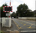
Newcastle Crossing, Nantwich
Level crossing on London Road.
Image: © JThomas
Taken: 12 Nov 2016
0.11 miles


