1
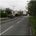
Brown Avenue bungalows, Nantwich
Originally, bungalow was used in English for a lightly-built house, with a veranda and one storey.
In current UK usage it is a convenient word for any one-storey dwelling.
Image: © Jaggery
Taken: 13 Oct 2016
0.09 miles
2
Jan Palach Avenue, Nantwich
The southern end of Jan Palach Avenue viewed from Brown Avenue. The avenue was named in memory of Jan Palach (1948–1969), a Czech student who set himself on fire in Wenceslas Square Prague on January 16th 1969 as a political protest against the end of the Prague Spring after the invasion of Czechoslovakia by the Warsaw Pact armies in 1968. He died on January 19th 1969. According to one online source, this is the only street so named in the UK.
Image: © Jaggery
Taken: 13 Oct 2016
0.10 miles
3
Brown Avenue, Nantwich
From the corner of Marlowe Drive. The Brown Avenue name sign is in the hedge on the right.
Image: © Jaggery
Taken: 13 Oct 2016
0.10 miles
4
East along Marlowe Drive, Nantwich
From the corner of Delamere Road along Marlowe Drive towards Brown Avenue.
Image: © Jaggery
Taken: 13 Oct 2016
0.11 miles
5
Southern end of Brown Avenue, Nantwich
Viewed from the corner of Marlowe Drive.
Image: © Jaggery
Taken: 13 Oct 2016
0.15 miles
6
Cherry Blossom
Spring time in the neighbourhood.
Image: © Caroline Hampton
Taken: 15 Mar 2008
0.17 miles
7
Windsor Avenue bungalows, Nantwich
Viewed from the corner of Delamere Road.
Image: © Jaggery
Taken: 13 Oct 2016
0.18 miles
8
Direction signs facing Audlem Road, Nantwich
Near the A529/A530 junction, go right on the A530 for Dagfields Crafts & Antiques and Bridgemere Garden World. Also go right for Crewe, Stoke-on-Trent, Chester, Wrexham.
Image: © Jaggery
Taken: 13 Oct 2016
0.22 miles
9
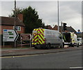
Wait here until green light shows, Audlem Road, Nantwich
During roadworks in October 2016, the permanent traffic lights at the A529/A530 junction
have been turned off and covered with hoods, and replaced by temporary traffic lights.
Image: © Jaggery
Taken: 13 Oct 2016
0.22 miles
10
Bend in Delamere Road, Nantwich
East of the Mayflower Road junction.
Image: © Jaggery
Taken: 13 Oct 2016
0.22 miles


