IMAGES TAKEN NEAR TO
Horton Way, NANTWICH, CW5 7GD

Introduction

This page details the photographs taken nearby to Horton Way, CW5 7GD by members of the Geograph project.

The Geograph project started in 2005 with the aim of publishing, organising and preserving representative images for every square kilometre of Great Britain, Ireland and the Isle of Man.

There are currently over 7.5m images from over14,400 individuals and you can help contribute to the project by visiting https://www.geograph.org.uk

Image Map


Images are licensed for reuse under creativecommons.org/licenses/by-sa/2.0
Notes
  • Clicking on the map will re-center to the selected point.
  • The higher the marker number, the further away the image location is from the centre of the postcode.

Image Listing (41 Images Found)

Images are licensed for reuse under creativecommons.org/licenses/by-sa/2.0
  • ...
Image
Details
Distance
1
Housing in Flowerscroft, Nantwich
From railway line
Image: © John Firth Taken: 18 Aug 2011
0.10 miles
2
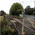
Railway from Newcastle Crossing towards Nantwich railway station
Looking west from this http://www.geograph.org.uk/photo/5156743 London Road level crossing. Out of shot ahead, Nantwich railway station is about a kilometre from the crossing.
Image: © Jaggery Taken: 13 Oct 2016
0.13 miles
3
London Road houses, Nantwich
On the south side of the B5074 London Road.
Image: © Jaggery Taken: 13 Oct 2016
0.16 miles
4
Almar House, Nantwich
Newly built house viewed across London Road on October 13th 2016.
Image: © Jaggery Taken: 13 Oct 2016
0.16 miles
5
Farewell Nantwich, Floral Market Town
The sign facing eastbound traffic on the B5074 London Road is on the back of this http://www.geograph.org.uk/photo/5242400 Welcome sign.
Image: © Jaggery Taken: 13 Oct 2016
0.17 miles
6
Welcome to Nantwich, Floral Market Town
The Welcome sign opposite St Joseph's Way faces westbound traffic on the B5074 London Road. Nantwich is a market town and civil parish in the Borough of Cheshire East. Nantwich's population on the day of the 2011 Census was 17,424.
Image: © Jaggery Taken: 13 Oct 2016
0.17 miles
7
Nantwich - London Road at St Joseph's Way
Image: © Peter Whatley Taken: 7 Dec 2011
0.17 miles
8
Railway towards Whitchurch
Looking west from Newcastle Crossing, Nantwich
Image: © JThomas Taken: 12 Nov 2016
0.18 miles
9
London Road, Nantwich
Looking south east.
Image: © JThomas Taken: 12 Nov 2016
0.18 miles
10
Queen Elizabeth II postbox, St Joseph's Way, Nantwich
Located here, http://www.geograph.org.uk/photo/5242392 near the London Road junction.
Image: © Jaggery Taken: 13 Oct 2016
0.18 miles
  • ...