IMAGES TAKEN NEAR TO
Middlewich Road, NANTWICH, CW5 6RU
Introduction
This page details the photographs taken nearby to Middlewich Road, CW5 6RU by members of the Geograph project.
The Geograph project started in 2005 with the aim of publishing, organising and preserving representative images for every square kilometre of Great Britain, Ireland and the Isle of Man.

There are currently over 7.5m images from over14,400 individuals and you can help contribute to the project by visiting https://www.geograph.org.uk
Image Map
Images are licensed for reuse under creativecommons.org/licenses/by-sa/2.0
Notes
- Clicking on the map will re-center to the selected point.
- The higher the marker number, the further away the image location is from the centre of the postcode.
Image Listing (13 Images Found)
Images are licensed for reuse under creativecommons.org/licenses/by-sa/2.0
Image
Details
Distance
1
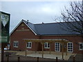
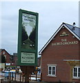
The Sacred Orchard
New public house on the A51
Image: © JThomas
Taken: 3 Dec 2016
0.01 miles
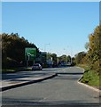
3
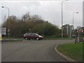
Roundabout scene on the Nantwich bypass
Image: © Peter Whatley
Taken: 7 Dec 2011
0.03 miles
4
A530 roundabout on the Nantwich bypass
Image: © Peter Whatley
Taken: 7 Dec 2011
0.05 miles
5
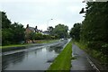
Cycle path near Alvaston Roundabout
Looking along Middlewich Road. The path is part of National Cycle Network route 451.
Image: © DS Pugh
Taken: 6 Aug 2023
0.05 miles
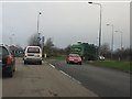
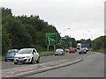
7
The A500, Nantwich by-pass
The A500 runs from Nantwich to junction 16 of the M6
Image: © Margaret Sutton
Taken: 25 Oct 2010
0.14 miles
8
Approaching Alvaston Roundabout
Looking northwest along the Nantwich Bypass [A51].
Image: © M J Richardson
Taken: 21 Sep 2013
0.14 miles
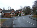
9
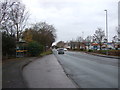
Bus stop and shelter on Middlewich Road (B5334)
Image: © JThomas
Taken: 3 Dec 2016
0.14 miles
10
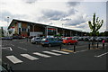
Sainsbury's superstore, Nantwich
Image: © Christopher Hilton
Taken: 26 May 2014
0.18 miles