IMAGES TAKEN NEAR TO
Calveley Hall Lane, NANTWICH, CW5 6BS
Introduction
This page details the photographs taken nearby to Calveley Hall Lane, CW5 6BS by members of the Geograph project.
The Geograph project started in 2005 with the aim of publishing, organising and preserving representative images for every square kilometre of Great Britain, Ireland and the Isle of Man.

There are currently over 7.5m images from over14,400 individuals and you can help contribute to the project by visiting https://www.geograph.org.uk
Image Map
Images are licensed for reuse under creativecommons.org/licenses/by-sa/2.0
Notes
- Clicking on the map will re-center to the selected point.
- The higher the marker number, the further away the image location is from the centre of the postcode.
Image Listing (5 Images Found)
Images are licensed for reuse under creativecommons.org/licenses/by-sa/2.0
Image
Details
Distance
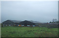
1
Humble Bee
Minor road to Humble Bee Bank Cottages, near Wardle.
Image: © J Scott
Taken: 27 Jan 2011
0.13 miles
2
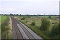
Holyhead to Crewe railway
Towards Crewe.
Image: © Richard Webb
Taken: 16 Jul 2019
0.13 miles
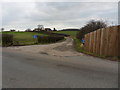
3
Railway bridge near Wardle Bridge Farm
Crossing the railway between Crewe and Chester (and on to Holyhead).
Image: © Richard Webb
Taken: 16 Jul 2019
0.15 miles
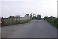
4
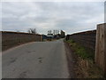
Slight hump
Calveley Hall Lane road bridge over railway line leading to Crewe.
Image: © J Scott
Taken: 27 Jan 2011
0.16 miles