1
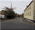
The Gullet in Nantwich
The Gullet on the north side of Hospital Street leads to the east side of St Mary's Church.
Image: © Jaggery
Taken: 13 Oct 2016
0.04 miles
2
St Mary's church
The oldest building in the town of Nantwich, built mainly in the 14th century in Cheshire red sandstone.
Image: © Margaret Sutton
Taken: 20 Aug 2007
0.04 miles
3
Sweetbriar Hall, Hospital Street
Grade-II-listed, black-and-white Elizabethan hall on Hospital Street. It pre-dates the fire of 1583, and is probably the oldest building in Nantwich apart from St Mary's Church. The date given differs between sources; some give 1450s, others 16th century
Image: © Espresso Addict
Taken: 16 Jun 2010
0.05 miles
4
Nantwich: Monks Lane
On the right, the former Baptist Chapel.
Image: © Christopher Hilton
Taken: 16 Feb 2015
0.05 miles
5
Nantwich: Dysart Buildings, Monks Lane
Image: © Christopher Hilton
Taken: 16 Feb 2015
0.05 miles
6
Church Lane Nantwich
Small cobbled back lane with shops and café's, in the town centre, running from St Mary's church Church to Hospital Street.
Image: © Gillie Rhodes
Taken: 28 May 2011
0.06 miles
7
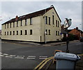
Globe House, Nantwich
Many-windowed office building on the corner of Hospital Street and The Gullet.
The entrance is at the left end of the building, from The Gullet.
Image: © Jaggery
Taken: 13 Oct 2016
0.06 miles
8
1828 in Hospital Street, Nantwich
1828 at 88 Hospital Street is a women's clothes shop specialising in sizes 18 to 28.
The Barrel & Tap http://www.geograph.org.uk/photo/5157617 is on the left.
Image: © Jaggery
Taken: 13 Oct 2016
0.06 miles
9
Hospital Street, Nantwich ? 1963
Still forming part of the A51 through the town, as part of a one-way system, although through traffic was routed via Millstone Lane and Beam Bridge.
Image: © Alan Murray-Rust
Taken: 15 Sep 1963
0.06 miles
10
Grade II listed Sweet Briar Hall, Hospital Street, Nantwich
The plaque http://www.geograph.org.uk/photo/5157326 on the left records that the building dates from the late 15th century.
The octagonal bay was added in the 16th century.
While a Unitarian minister, the scientist Joseph Priestley lived here from 1758-1761.
The building was undamaged by the Great Fire of 1583 which reached an adjoining building.
Image: © Jaggery
Taken: 13 Oct 2016
0.06 miles


