1
Semi-detached houses on Queens Drive
A large housing estate lies to the SW of Nantwich, bordered on the south and east by Queens Drive. The semi-detached houses here are typical of the older style of house in the estate. The grassed area on the right is Queens Drive Meadows. View north from the road bend
Image: © Espresso Addict
Taken: 9 Oct 2006
0.08 miles
2
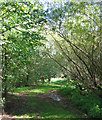
Leafy path at Queens Drive Meadows
The area adjacent to the railway line (out of view to the right) on Queens Drive Meadows is marshy with a belt of mixed broadleaved trees, including beech and willow
Image: © Espresso Addict
Taken: 9 Oct 2006
0.10 miles
3
Railway bridge over the Weaver
The Weaver here flows through pleasant recreational land, with many mature willows. View towards the railway bridge from pedestrian/cycle bridge by Queens Drive Meadows, part of the Nantwich cycle network
Image: © Espresso Addict
Taken: 3 Oct 2006
0.13 miles
4
Cycle path across Queens Drive Meadows
This recreational area between Queens Drive, the railway and the River Weaver is sometimes known as Queens Drive Meadows. The line of willows marks the river, with a pedestrian/cycle bridge visible in centre frame. The houses on left of frame are on Shrewbridge Road, near the boundary with
Image
Image: © Espresso Addict
Taken: 9 Oct 2006
0.13 miles
5
River Weaver at Queens Drive Meadows
View north from the pedestrian/cycle bridge. One of the several cycle paths on Queens Drive Meadows is visible on the left
Image: © Espresso Addict
Taken: 3 Oct 2006
0.13 miles
6
Ducks by the pedestrian bridge
Close up of the pedestrian/cycle bridge over the River Weaver, by Queens Drive Meadows
Image: © Espresso Addict
Taken: 9 Oct 2006
0.13 miles
7
Riverside footpath, Nantwich ? 1963
Footpaths across the meadows are now much more formalised.
The triangle to the left of the footpath has now become gardens to the houses out of sight to the left.
Image: © Alan Murray-Rust
Taken: 15 Sep 1963
0.15 miles
8
Railway bridge over the River Weaver, Nantwich
Image: © Christopher Hilton
Taken: 20 Feb 2021
0.17 miles
9
Railway bridge over the Weaver in Nantwich
The railway is the former LNWR line from Crewe to Shrewsbury. The GWR branch to Market Drayton came off just to the west (left) of here. The people in the photo are walking on the Nantwich Riverside Loop path.
Image: © Stephen Craven
Taken: 27 Sep 2015
0.18 miles
10
Shrewbridge Villas, SW Nantwich
Terrace of Victorian/Edwardian 'villas' immediately north of the level crossing on Shrewbridge Road; probably amongst the oldest houses in the gridsquare. The half-tiled open porches visible here are common in houses of this era in Nantwich and Crewe, although many have been altered. The street in the foreground lies on the boundary with
Image
Image: © Espresso Addict
Taken: 3 Oct 2006
0.19 miles


