IMAGES TAKEN NEAR TO
Orchard Close, CREWE, CW4 8JL
Introduction
This page details the photographs taken nearby to Orchard Close, CW4 8JL by members of the Geograph project.
The Geograph project started in 2005 with the aim of publishing, organising and preserving representative images for every square kilometre of Great Britain, Ireland and the Isle of Man.

There are currently over 7.5m images from over14,400 individuals and you can help contribute to the project by visiting https://www.geograph.org.uk
Image Map
Images are licensed for reuse under creativecommons.org/licenses/by-sa/2.0
Notes
- Clicking on the map will re-center to the selected point.
- The higher the marker number, the further away the image location is from the centre of the postcode.
Image Listing (25 Images Found)
Images are licensed for reuse under creativecommons.org/licenses/by-sa/2.0
Image
Details
Distance

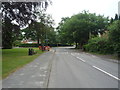
2
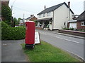
Main Road, Goostrey
Showing position of Postbox No. CW4 139.
See Image] for postbox.
Image: © JThomas
Taken: 11 Jun 2016
0.06 miles
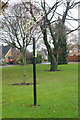
3
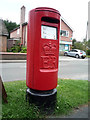
Elizabeth II postbox on Main Road, Goostrey
Postbox No. CW4 139.
See Image] for context.
Image: © JThomas
Taken: 11 Jun 2016
0.06 miles
5
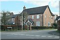
Around Goostrey (1)
House at Fieldside Close
Image: © Anthony O'Neil
Taken: 5 Mar 2022
0.08 miles
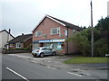
6

Christmas lights coming to Goostrey
The banner on the Bog Bean advertises the forthcoming switching on of the Christmas lights.
Image: © Stephen McKay
Taken: 27 Nov 2019
0.08 miles
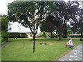
8
Goostrey village sign
Many village signs have elaborate designs depicting various aspects of local life and history but this one at Goostrey is a simpler affair. The small green on which it stands is known locally as the Bog Bean. At the 2011 census Goostrey had a population of just over 2,000 with housing stretching out over a mile to the west of the church. Originally an agricultural community in dairy farming countryside, Goostrey developed considerably in the 1960s and'70s and much of the housing stock reflects that period.
Image: © Stephen McKay
Taken: 27 Nov 2019
0.10 miles
10
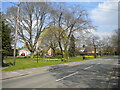
Village green with daffodils, Goostrey
Seen from Main Road, with the rather spindly village sign (left foreground) blending in with the still fairly bare trees.
Image: © Richard Vince
Taken: 17 Apr 2021
0.10 miles