
IMAGES TAKEN NEAR TO
Jodrell Bank, CREWE, CW4 8BU
Introduction
This page details the photographs taken nearby to Jodrell Bank, CW4 8BU by members of the Geograph project.
The Geograph project started in 2005 with the aim of publishing, organising and preserving representative images for every square kilometre of Great Britain, Ireland and the Isle of Man.

There are currently over 7.5m images from over14,400 individuals and you can help contribute to the project by visiting https://www.geograph.org.uk
Image Map
Images are licensed for reuse under creativecommons.org/licenses/by-sa/2.0
Notes
- Clicking on the map will re-center to the selected point.
- The higher the marker number, the further away the image location is from the centre of the postcode.
Image Listing (6 Images Found)
Images are licensed for reuse under creativecommons.org/licenses/by-sa/2.0
Image
Details
Distance
2
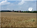
No tumulus here either
Like the one a couple of hundred yards to the west, there's no visible evidence of a tumulus here in the field just south of Jodrell Bank Farm.
Image: © Richard Law
Taken: 23 Jul 2010
0.11 miles
3
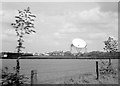
Jodrell Bank Farm and the telescope, 1961
View from the A535 near Fairholme.
Image: © Alan Murray-Rust
Taken: 20 May 1961
0.15 miles
4
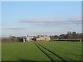
Jodrell Bank farm, Goostrey
Viewed from the railway a few hundred metres to the west. I presume the farm came first, before the radio telescope that gave this place worldwide fame.
Image: © Stephen Craven
Taken: 17 Apr 2016
0.21 miles
5
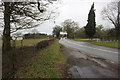
A535 Holmes Chapel Road at the B5392 junction, Lower Withington
Image: © Peter Turner
Taken: 22 Feb 2012
0.22 miles
6

Jodrell Bank Farm and surrounding fields, from the railway
Image: © Christopher Hilton
Taken: 3 Jun 2016
0.22 miles