IMAGES TAKEN NEAR TO
Danefield Road, CREWE, CW4 7NT
Introduction
This page details the photographs taken nearby to Danefield Road, CW4 7NT by members of the Geograph project.
The Geograph project started in 2005 with the aim of publishing, organising and preserving representative images for every square kilometre of Great Britain, Ireland and the Isle of Man.

There are currently over 7.5m images from over14,400 individuals and you can help contribute to the project by visiting https://www.geograph.org.uk
Image Map
Images are licensed for reuse under creativecommons.org/licenses/by-sa/2.0
Notes
- Clicking on the map will re-center to the selected point.
- The higher the marker number, the further away the image location is from the centre of the postcode.
Image Listing (71 Images Found)
Images are licensed for reuse under creativecommons.org/licenses/by-sa/2.0
Image
Details
Distance
1
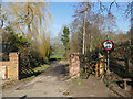
Start of Hermitage Lane
The lane is passable by vehicles but has the status of a restricted byway, so motor vehicles are forbidden except for access.
Image: © Stephen Craven
Taken: 23 Feb 2019
0.07 miles
2
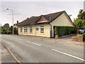
St Margaret Ward Roman Catholic Church, Holmes Chapel
Image: © David Dixon
Taken: 8 Sep 2014
0.14 miles
3
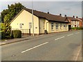
St Margaret Ward Roman Catholic Church, Macclesfield Road
Image: © David Dixon
Taken: 8 Sep 2014
0.15 miles
4
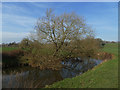
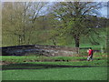
Tree growing across the river
It's growing out of the left bank, but reaching almost to the right.
Image: © Stephen Craven
Taken: 23 Feb 2019
0.18 miles
5
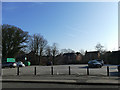
Car park of the George and Dragon
Off Crofters Court.
Image: © Stephen Craven
Taken: 23 Feb 2019
0.18 miles
6
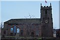
St Luke's Church, Holmes Chapel
An evening shot of St Luke's Church
Image: © Terry Robinson
Taken: 22 Mar 2008
0.19 miles
7
On the Dane Valley Way, View WNW to Hermitage Bridge, Holmes Chapel
Image: © Colin Park
Taken: 3 Nov 2014
0.19 miles
9
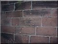
Musket Ball marks on St Luke's Church, Holmes Chapel
These marks, on the church tower wall are from Musket Balls fired during the English Civil War.
Image: © Terry Robinson
Taken: 22 Mar 2008
0.19 miles
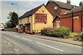
10
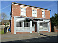
Don Alberto, Holmes Chapel
An Italian restaurant on Macclesfield Road.
Image: © Stephen Craven
Taken: 23 Feb 2019
0.19 miles