
IMAGES TAKEN NEAR TO
Church View, CREWE, CW4 7AG
Introduction
This page details the photographs taken nearby to Church View, CW4 7AG by members of the Geograph project.
The Geograph project started in 2005 with the aim of publishing, organising and preserving representative images for every square kilometre of Great Britain, Ireland and the Isle of Man.

There are currently over 7.5m images from over14,400 individuals and you can help contribute to the project by visiting https://www.geograph.org.uk
Image Map
Images are licensed for reuse under creativecommons.org/licenses/by-sa/2.0
Notes
- Clicking on the map will re-center to the selected point.
- The higher the marker number, the further away the image location is from the centre of the postcode.
Image Listing (72 Images Found)
Images are licensed for reuse under creativecommons.org/licenses/by-sa/2.0
Image
Details
Distance
1
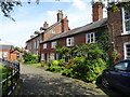
Three cottages in Church View
The 19C cottages are Grade II listed as part of the group around the church. I think the comment 'Generally modernised and of no special interest.' may be a little harsh.
Image: © John M
Taken: 10 Aug 2017
0.01 miles
2
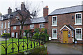
Church View, Holmes Chapel
Church View is a crescent running round the east side of St Luke's church. The town house on the left is one of a pair dating from the early 18th century; the three cottages to its right are early 19th century with later alterations. They are all grade II listed. The cottage on the right in this view is called 'Thimble Cottage'.
Image: © Stephen McKay
Taken: 27 Nov 2019
0.01 miles
3
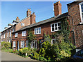
Church View, Holmes Chapel
This row of cottages, along with the church itself, were among the few buildings to survive the great fire of 1753. They are listed grade II (list entry 1278215).
Image: © Stephen Craven
Taken: 23 Feb 2019
0.01 miles
4
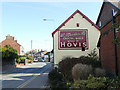
Manderville's, Holmes Chapel
This long-established delicatessen bears a traditional Hovis sign.
Image: © Stephen Craven
Taken: 23 Feb 2019
0.01 miles
5

St Luke's, Holmes Chapel - east end
The brick walls of the chancel and nave date from the early 18th century. The upper level of windows lights the galleries.
Image: © Stephen Craven
Taken: 23 Feb 2019
0.02 miles
6
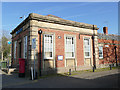
Barclays Bank, Holmes Chapel
On the corner of London Road and Macclesfield Road.
Image: © Stephen Craven
Taken: 23 Feb 2019
0.02 miles
7
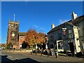
Church of St Luke and the Old Red Lion
On The Square, Holmes Chapel
Image: © Graham Hogg
Taken: 21 Nov 2021
0.02 miles
8
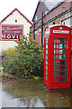
Macclesfield Road, Homes Chapel
The K6 telephone box in the foreground now houses a defibrillator; further along the business of W. Mandeville 'grocer and baker' is very much alive.
Image: © Stephen McKay
Taken: 27 Nov 2019
0.02 miles
9
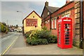
Holmes Chapel
Looking east along Macclesfield Road (A535) from the junction with London Road (A50) at Holmes Chapel.
Image: © David Dixon
Taken: 8 Sep 2014
0.02 miles
10
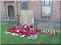
St Luke's, Holmes Chapel - war memorial
The memorial in the churchyard covers both World Wars.
Image: © Stephen Craven
Taken: 23 Feb 2019
0.02 miles