
IMAGES TAKEN NEAR TO
Blaizefield Close, CREWE, CW3 9SU
Introduction
This page details the photographs taken nearby to Blaizefield Close, CW3 9SU by members of the Geograph project.
The Geograph project started in 2005 with the aim of publishing, organising and preserving representative images for every square kilometre of Great Britain, Ireland and the Isle of Man.

There are currently over 7.5m images from over14,400 individuals and you can help contribute to the project by visiting https://www.geograph.org.uk
Image Map
Images are licensed for reuse under creativecommons.org/licenses/by-sa/2.0
Notes
- Clicking on the map will re-center to the selected point.
- The higher the marker number, the further away the image location is from the centre of the postcode.
Image Listing (35 Images Found)
Images are licensed for reuse under creativecommons.org/licenses/by-sa/2.0
Image
Details
Distance
1
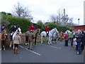
Woore: North Staffordshire Hunt's Boxing Day Meet 2015
Image: © Jonathan Hutchins
Taken: 26 Dec 2015
0.10 miles
2
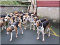
Foxhounds at the Boxing Day Meet
The North Staffordshire Hunt assembles in the car park of The Swan at Woore before moving off.
Image: © Jonathan Hutchins
Taken: 26 Dec 2015
0.11 miles
3

Boxing Day meet at the Swan at Woore
Image: © Jonathan Hutchins
Taken: 26 Dec 2012
0.12 miles
4
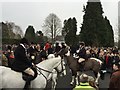
Boxing Day meet at the Swan at Woore
The North Staffordshire Hunt traditionally assembles in the large car park opposite the Swan in Woore, before setting off.
Image: © Jonathan Hutchins
Taken: 26 Dec 2014
0.12 miles
5
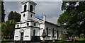
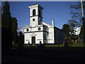
St Leonard's Church, Woore
Woore is now a separate parish of Shropshire, but was formerly part of Mucklestone, a Staffordshire parish. St. Leonard's church was built in 1830-31 to designs by George Hamilton of Stone. The west front and chancel was rebuilt in 1887.
Image: © Colin Kinnear
Taken: 3 Jun 2021
0.12 miles
7
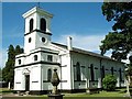
St Leonard's Church, Woore
St. Leonard's church was constructed in 1832 and is of an unconventional white plaster design
Image: © Steve Parkin
Taken: Unknown
0.13 miles
9
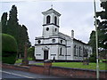
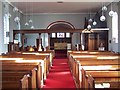
St Leonard's Church, Woore
The present church stands near the site of an earlier chapel-of-ease, first recorded in 1552. http://www.imagesofengland.org.uk/Details/Default.aspx?id=260453&mode=quick
Image: © Eirian Evans
Taken: 5 Aug 2008
0.13 miles
10
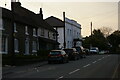
Nantwich Road, Woore, at sunset
The tall white building with the porch is Swan Court, a relatively recent residential development made by converting the former Swan Inn.
For a small settlement, Woore is rich in pubs - the Coopers Arms and the Falcon still survive in the centre of the village, and the Chetwode Arms a little to the south. This is presumably due to the importance of the road running through it: the A51 is the London Road when it leaves Nantwich and runs via Stone to connect with major arteries south. When these pubs were built it would have been a busy artery connecting Cheshire to the south and the capital.
Image: © Christopher Hilton
Taken: 18 Apr 2021
0.13 miles