IMAGES TAKEN NEAR TO
Jack Lane, CREWE, CW2 5LE
Introduction
This page details the photographs taken nearby to Jack Lane, CW2 5LE by members of the Geograph project.
The Geograph project started in 2005 with the aim of publishing, organising and preserving representative images for every square kilometre of Great Britain, Ireland and the Isle of Man.

There are currently over 7.5m images from over14,400 individuals and you can help contribute to the project by visiting https://www.geograph.org.uk
Image Map
Images are licensed for reuse under creativecommons.org/licenses/by-sa/2.0
Notes
- Clicking on the map will re-center to the selected point.
- The higher the marker number, the further away the image location is from the centre of the postcode.
Image Listing (2 Images Found)
Images are licensed for reuse under creativecommons.org/licenses/by-sa/2.0
Image
Details
Distance
1
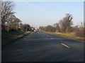
A5020 approaching the farm access crossroads
Image: © Peter Whatley
Taken: 21 Jan 2011
0.09 miles
2
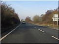
A5020 north of Meremoor roundabout
An almost dead straight road across Meremoor Moss.
Image: © Peter Whatley
Taken: 21 Jan 2011
0.21 miles