1
Crewe Fire Station
A charity car wash was being held at the rear of the station and I had gone to take some pictures for flickr.
http://www.flickr.com/photos/grotspot/
Image: © Terry Hughes
Taken: 5 Jul 2009
0.05 miles
2
Crewe Community Fire Station and training tower
This is the A532 Macon Way side of the fire station on the corner of the A534 Crewe Road.
The station is part of the Cheshire Fire and Rescue Service.
Image: © Jaggery
Taken: 10 Sep 2016
0.05 miles
3
South side of Crewe Community Fire Station and training tower
A534 Crewe Road side of the fire station on the corner of the A532 Macon Way. http://www.geograph.org.uk/photo/5111779 to the opposite side.
http://www.geograph.org.uk/photo/5111802 to the name sign. The station is part of the Cheshire Fire and Rescue Service.
Image: © Jaggery
Taken: 10 Sep 2016
0.06 miles
4
Crewe Community Fire Station name sign
Located on the left here. http://www.geograph.org.uk/photo/5111794
Image: © Jaggery
Taken: 10 Sep 2016
0.07 miles
5
Crewe Fire Station
Off Macon Way.
Image: © John Topping
Taken: 6 Jun 2013
0.07 miles
6
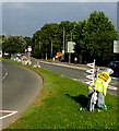
IRIS bicycle on the grass strip in the middle of the A534 Crewe Road, Crewe
Viewed on September 10th 2016. The IRIS bicycle and the decorated bicycles ahead were installed here to mark the passage along this route of the Tour of Britain cycle race on September 6th 2016. IRIS is a charity providing services for visually impaired people in Cheshire and surrounding areas.
Image: © Jaggery
Taken: 10 Sep 2016
0.07 miles
7
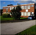
Macon House Day Centre, Crewe
Cheshire East Council premises viewed across the A532 Macon Way. Staff at the day centre support people with complex healthcare and specialist needs. The Crewe Community Fire Station http://www.geograph.org.uk/photo/5111779 tower is on the right.
Image: © Jaggery
Taken: 10 Sep 2016
0.08 miles
8
Crewe fire station
Crewe fire station, Macon Way, Crewe, Cheshire.
Image: © Kevin Hale
Taken: 21 Oct 2006
0.08 miles
9
Macon House
Providing care services for people with learning difficulties.
Image: © John M
Taken: 17 Mar 2016
0.08 miles
10
Macon House Day Centre, Crewe
Cheshire East Council premises set back from the east side of the A532 Macon Way.
Staff at the day centre support people with complex healthcare and specialist needs.
Image: © Jaggery
Taken: 10 Sep 2016
0.08 miles


