IMAGES TAKEN NEAR TO
Weston Road, CREWE, CW1 6BA
Introduction
This page details the photographs taken nearby to Weston Road, CW1 6BA by members of the Geograph project.
The Geograph project started in 2005 with the aim of publishing, organising and preserving representative images for every square kilometre of Great Britain, Ireland and the Isle of Man.

There are currently over 7.5m images from over14,400 individuals and you can help contribute to the project by visiting https://www.geograph.org.uk
Image Map
Images are licensed for reuse under creativecommons.org/licenses/by-sa/2.0
Notes
- Clicking on the map will re-center to the selected point.
- The higher the marker number, the further away the image location is from the centre of the postcode.
Image Listing (440 Images Found)
Images are licensed for reuse under creativecommons.org/licenses/by-sa/2.0
Image
Details
Distance
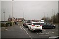
2
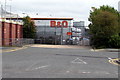
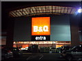
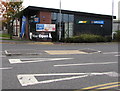
Entrance to the B&Q delivery area, Crewe
From Weston Road Delivery Road into the SE corner of the B&Q superstore in Weston Road.
Image: © Jaggery
Taken: 23 Sep 2017
0.06 miles
3
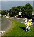
IRIS bicycle on the grass strip in the middle of the A534 Crewe Road, Crewe
Viewed on September 10th 2016. The IRIS bicycle and the decorated bicycles ahead were installed here to mark the passage along this route of the Tour of Britain cycle race on September 6th 2016. IRIS is a charity providing services for visually impaired people in Cheshire and surrounding areas.
Image: © Jaggery
Taken: 10 Sep 2016
0.08 miles
4
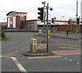
Pelican crossings near B&Q Crewe
Across the A532 Weston Road. Chambers Dictionary states that pelican
in this context is adapted from "pedestrian light controlled crossing".
Image: © Jaggery
Taken: 23 Sep 2017
0.08 miles
5
Greggs and Subway near Crewe railway station
Alongside the A532 Weston Road.
Image: © Jaggery
Taken: 23 Sep 2017
0.09 miles
6
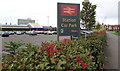
Crewe Railway Station Car Park name sign
In September 2017 the Virgin Trains logo is in the lower right corner of the sign facing the A532 Weston Road.
Image: © Jaggery
Taken: 23 Sep 2017
0.09 miles
7
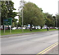
Distances from Crewe
The sign alongside the A532 Weston Road is 5 miles from Nantwich and the M6 Motorway,
12 from Newcastle-under-Lyme and 14 from Stoke-on-Trent.
Image: © Jaggery
Taken: 23 Sep 2017
0.09 miles
8
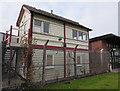
Former Nantwich Station signalbox in Crewe
Located in the OSL Rail Ltd site in Weston Road, Crewe, the signalbox is now used by railway apprentices. Network Rail paid for the removal of the redundant signalbox from Nantwich to Crewe at the end of January 2016 after campaigners who strove to keep this piece of railway history in Nantwich were unable to acquire land next to the Methodist Church in Hospital Street Nantwich.
Image: © Jaggery
Taken: 23 Sep 2017
0.10 miles
10
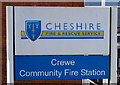
Crewe Community Fire Station name sign
Located on the left here. http://www.geograph.org.uk/photo/5111794
Image: © Jaggery
Taken: 10 Sep 2016
0.10 miles