IMAGES TAKEN NEAR TO
Nutfield Avenue, CREWE, CW1 3RU
Introduction
This page details the photographs taken nearby to Nutfield Avenue, CW1 3RU by members of the Geograph project.
The Geograph project started in 2005 with the aim of publishing, organising and preserving representative images for every square kilometre of Great Britain, Ireland and the Isle of Man.

There are currently over 7.5m images from over14,400 individuals and you can help contribute to the project by visiting https://www.geograph.org.uk
Image Map
Images are licensed for reuse under creativecommons.org/licenses/by-sa/2.0
Notes
- Clicking on the map will re-center to the selected point.
- The higher the marker number, the further away the image location is from the centre of the postcode.
Image Listing (9 Images Found)
Images are licensed for reuse under creativecommons.org/licenses/by-sa/2.0
Image
Details
Distance
2
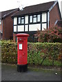
Elizabeth II postbox on Mablins Lane
Postbox No. CW1 112.
See Image] for context.
Image: © JThomas
Taken: 29 Oct 2016
0.13 miles
3
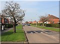
Road humps on Selworthy Drive
This whole area is plastered with these very large traffic calming road humps.
Image: © David P Howard
Taken: 22 Mar 2012
0.13 miles
4
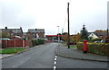
Mablins Lane, Crewe
Looking south showing position of Postbox No. CW1 112.
See Image] for postbox.
Image: © JThomas
Taken: 29 Oct 2016
0.13 miles
5
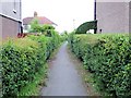
Crewe - ginnel from Underwood Lane to Pear Tree Avenue
Crewe. View from Underwood Way along the ginnel that runs to Pear Tree Avenue. Typical of the back streets of so many towns.
Image: © Mike Harris
Taken: 18 May 2008
0.14 miles
6
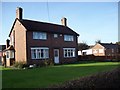
Mablins Lane Farm
A small farm surrounded on all sides by houses.
Image: © Tom McCallister
Taken: 16 Nov 2008
0.16 miles