1
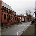
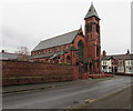
St Mary's Church, Crewe: west front
Grade-II-listed red-brick Roman Catholic church by Pugin & Pugin dating from 1890-1. This view of the front (west) is from St Mary's Road and shows the narrow square tower on the SW corner. See
Image for the view from the rear
Image: © Espresso Addict
Taken: 30 Mar 2012
0.03 miles
2
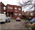
St Mary's Church, Crewe: rear view
Grade-II-listed red-brick Roman Catholic church by Pugin & Pugin dating from 1890-1. This view of the rear is from Delamere Street; the junction with Gatefield Street is on the right. See
Image for the view from the front
Image: © Espresso Addict
Taken: 30 Mar 2012
0.03 miles
3
East along Delamere Street, Crewe
Between St Mary's Street and Gatefield Street. The southern edge of St Mary's RC Church is on the left. http://www.geograph.org.uk/photo/5294357
Image: © Jaggery
Taken: 15 Feb 2017
0.04 miles
4
Steps up to Crewe Liberal Club
The St Mary's Street side of the club at 1 Gatefield Street in Crewe.
Image: © Jaggery
Taken: 15 Feb 2017
0.04 miles
5
Delamere Street electricity substation, Crewe
The SP Manweb electricity substation identifier 06/7055/021 is at the edge of a car park.
Wellington House http://www.geograph.org.uk/photo/5294442 is on the right.
Image: © Jaggery
Taken: 15 Feb 2017
0.04 miles
6
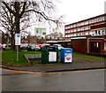
Delamere Street recycling area, Crewe
The green bin is for shoes and clothes. The blue bin is for shoes.
Image: © Jaggery
Taken: 15 Feb 2017
0.04 miles
7
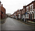
North along Gatefield Street, Crewe
One-way street extending for 120 metres from Delamere Street to Victoria Street.
Image: © Jaggery
Taken: 15 Feb 2017
0.04 miles
8
Delamere Resource Centre, Crewe
Cheshire & Wirral Partnership NHS Foundation Trust premises at 45 Delamere Street.
Image: © Jaggery
Taken: 15 Feb 2017
0.04 miles
9
47 Delamere Street, Crewe
This substantial grade-II-listed red-brick house dates from 1850, which puts it among the older surviving buildings in Crewe. It features an elaborate timber porch and a large oriel window (left). Built as a railway manager's house, it has also housed a convent. St Mary's Roman Catholic church stands opposite (just visible right); see
Image
Image: © Espresso Addict
Taken: 30 Mar 2012
0.04 miles
10
St Mary's R.C. Church, Crewe
Roman Catholic church in the Diocese of Shrewsbury viewed across St Mary's Street.
Image: © Jaggery
Taken: 15 Feb 2017
0.04 miles


