1
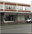
Steam Nightclub, High Street, Crewe
The High Street is now a rather unappealing backstreet off Edleston Road. The tall Steam Nightclub building has been operated as a nightclub under a variety of names for many years. Its impressive front facade is rather out of place these days. The side lettering, prominent from the railway bridge on Edleston Road, reads 'Kettell's Restaurant'
Image: © Espresso Addict
Taken: 30 Mar 2012
0.03 miles
2
Hand Car Wash Express in Crewe town centre
At the western end of High Street.
Image: © Jaggery
Taken: 15 Feb 2017
0.04 miles
3
British Red Cross charity shop in Crewe town centre
The shop at 4 Market Street is next door to a vacant shop in February 2017.
Image: © Jaggery
Taken: 15 Feb 2017
0.04 miles
4
The tower and ruins of Christ Church, Crewe
Looking towards the freestanding tower of Christ Church, which was retained when large parts of the church were demolished between 1977-1979 due to dry rot. In the foreground are parts of the former wall of the church, and services are still held in a section that still stands. http://www.scfhs.org.uk/scfhs/christchurch_crewe_intro.html
The tower still contains a full ring of ten bells (more than most churches which rarely have more than eight) and is highly regarded in bell ringing circles. http://dove.cccbr.org.uk/detail.php?searchString=crewe&Submit=+Go+&DoveID=CREWE
(Thanks to Stephen Craven for the information regarding the bells)
Image: © John S Turner
Taken: 16 Oct 2009
0.05 miles
5
Part of the remains of Christ Church, Crewe
This small gable end is part of the west end of Christ Church which was built in 1845, but was partly demolished between 1977-1979 due to dry rot. Sections of the church do still stand and services are held there. http://www.scfhs.org.uk/scfhs/christchurch_crewe_intro.html
Image: © John S Turner
Taken: 16 Oct 2009
0.05 miles
6
Plaque in Christ Church Memorial Garden
This plaque is within the area that was once inside Christ Church. Built in 1845 the church was partly demolished between 1977-1979. The open space is now a memorial garden, and services are still held in the parts of the building that remain.
Image: © John S Turner
Taken: 16 Oct 2009
0.05 miles
7
A pillar of Christ Church
This is one of the remaining pillars that were left when a large part of the Christ Church was demolished in 1977. The plaque above the door commemorates that the church was built in 1845 by the Grand Junction Railway Company, was partly demolished in 1977, and was re-opened in 1979.
Image: © John S Turner
Taken: 16 Oct 2009
0.05 miles
8
Market Street, Crewe
Looking north along Market Street from Chester Bridge.
Image: © John S Turner
Taken: 16 Oct 2009
0.05 miles
9
Chester Bridge and a bench mark
Looking across Chester Bridge in the direction of Edleston Road. On the right, and just below the top of the demolished wall, there is a bench mark -
Image
Image: © John S Turner
Taken: 16 Oct 2009
0.05 miles
10
Chester Bridge and Market Street
Looking towards Chester Bridge from Market Street.
Image: © John S Turner
Taken: 16 Oct 2009
0.05 miles


