IMAGES TAKEN NEAR TO
Ennerdale Drive, CONGLETON, CW12 4FR
Introduction
This page details the photographs taken nearby to Ennerdale Drive, CW12 4FR by members of the Geograph project.
The Geograph project started in 2005 with the aim of publishing, organising and preserving representative images for every square kilometre of Great Britain, Ireland and the Isle of Man.

There are currently over 7.5m images from over14,400 individuals and you can help contribute to the project by visiting https://www.geograph.org.uk
Image Map
Images are licensed for reuse under creativecommons.org/licenses/by-sa/2.0
Notes
- Clicking on the map will re-center to the selected point.
- The higher the marker number, the further away the image location is from the centre of the postcode.
Image Listing (43 Images Found)
Images are licensed for reuse under creativecommons.org/licenses/by-sa/2.0
Image
Details
Distance
1
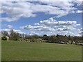
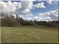
Grassland and shrubs bordering Astbury Mere
Image: © Jonathan Hutchins
Taken: 7 Apr 2021
0.05 miles
2
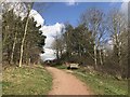
Path at Astbury Mere Country Park
Image: © Jonathan Hutchins
Taken: 25 Mar 2018
0.06 miles
3
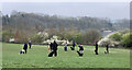
Dog training at Astbury Mere Country Park
Image: © Jonathan Hutchins
Taken: 30 Mar 2019
0.07 miles
4

Astbury Mere Country Park Congleton
Seats near the car park
Image: © norman griffin
Taken: 25 Aug 2012
0.07 miles
5
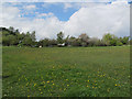
Meadow with dandelions, Astbury Mere Country Park
Near the north car park.
Image: © Stephen Craven
Taken: 3 May 2015
0.08 miles
7
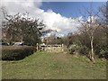
Emergency access gate at Astbury Mere Country Park
Image: © Jonathan Hutchins
Taken: 25 Mar 2018
0.09 miles
8
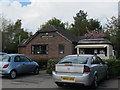
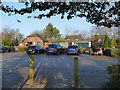
Astbury Mere Visitor Centre
In the northern car park.
Image: © Stephen Craven
Taken: 3 May 2015
0.09 miles
9
Astbury Mere
Buildings at the Astbury Mere Country Park.
Image: © Peter McDermott
Taken: 13 Jul 2023
0.09 miles
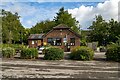
10
Astbury Mere - northern car park
The building in the background is the visitor centre Image
Image: © Stephen Craven
Taken: 1 Jan 2020
0.09 miles