IMAGES TAKEN NEAR TO
Garden Street, CONGLETON, CW12 4ET

Introduction

This page details the photographs taken nearby to Garden Street, CW12 4ET by members of the Geograph project.

The Geograph project started in 2005 with the aim of publishing, organising and preserving representative images for every square kilometre of Great Britain, Ireland and the Isle of Man.

There are currently over 7.5m images from over14,400 individuals and you can help contribute to the project by visiting https://www.geograph.org.uk

Image Map


Images are licensed for reuse under creativecommons.org/licenses/by-sa/2.0
Notes
  • Clicking on the map will re-center to the selected point.
  • The higher the marker number, the further away the image location is from the centre of the postcode.

Image Listing (27 Images Found)

Images are licensed for reuse under creativecommons.org/licenses/by-sa/2.0
  • ...
Image
Details
Distance
1
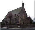
St. Mary's Roman Catholic Chapel, Congleton
Image: © nick macneill Taken: 1 Sep 2011
0.03 miles
2
A34 West Road
Heading west at Congleton
Image: © Kenneth Allen Taken: 30 May 2012
0.03 miles
3
Congleton, West Road
Image: © David Dixon Taken: 17 Jul 2014
0.05 miles
4
Congleton fire station
Congleton fire station, West Road, Congleton, Cheshire.
Image: © Kevin Hale Taken: 12 Jun 2006
0.11 miles
5
Church of St James the Great
Looking at the north and west elevations. The first stone to be laid in the building of the Church of St James the Great was done by the then High Steward of the Borough of Congleton, Randle Wilbraham Esq, in May of 1847. The architect was James Trubshaw of Newcastle under Lyme; the chief contractor was Samuel Faram of Odd Rode with the woodwork being under the direction of Edward Massey of Lawton. The building work was paid for by public subscription along with grants from the Chester Diocesan Society, the Incorporated Society and the Church Commissioners. It is built in the style of the transitional period of Early English; this is evident in the steep roof that forms an equilateral triangle to the windows and doorways. The church is built of local, Cloud-side, gritstone with a Westmoreland slate roof. The church was consecrated by the Bishop of Chester Dr Graham on Wednesday 27th January 1849
Image: © Jonathan Kington Taken: 20 Mar 2011
0.13 miles
6
West Road, Congleton
Image: © David Dixon Taken: 17 Jul 2014
0.13 miles
7
Road at Congleton
Heading west
Image: © Kenneth Allen Taken: 30 May 2012
0.14 miles
8
Bench mark on the Church of St James the Great
Located at the base of one of the buttresses on the east end of the church (Image). For more information on this and other bench marks go to http://www.bench-marks.org.uk/bm37363 .
Image: © Jonathan Kington Taken: 20 Mar 2011
0.14 miles
9
Church of St James the Great
Showing the north and east elevations. There is a bench mark on one of the buttresses at the south-east corner (Image). The first stone to be laid in the building of the Church of St James the Great was done by the then High Steward of the Borough of Congleton, Randle Wilbraham Esq, in May of 1847. The architect was James Trubshaw of Newcastle under Lyme; the chief contractor was Samuel Faram of Odd Rode with the woodwork being under the direction of Edward Massey of Lawton. The building work was paid for by public subscription along with grants from the Chester Diocesan Society, the Incorporated Society and the Church Commissioners. It is built in the style of the transitional period of Early English; this is evident in the steep roof that forms an equilateral triangle to the windows and doorways. The church is built of local, Cloud-side, gritstone with a Westmoreland slate roof. The church was consecrated by the Bishop of Chester Dr Graham on Wednesday 27th January 1849
Image: © Jonathan Kington Taken: 20 Mar 2011
0.14 miles
10
Road at Congleton
Heading west
Image: © Kenneth Allen Taken: 30 May 2012
0.16 miles
  • ...