
IMAGES TAKEN NEAR TO
Weathercock Lane, CONGLETON, CW12 3PP
Introduction
This page details the photographs taken nearby to Weathercock Lane, CW12 3PP by members of the Geograph project.
The Geograph project started in 2005 with the aim of publishing, organising and preserving representative images for every square kilometre of Great Britain, Ireland and the Isle of Man.

There are currently over 7.5m images from over14,400 individuals and you can help contribute to the project by visiting https://www.geograph.org.uk
Image Map
Images are licensed for reuse under creativecommons.org/licenses/by-sa/2.0
Notes
- Clicking on the map will re-center to the selected point.
- The higher the marker number, the further away the image location is from the centre of the postcode.
Image Listing (18 Images Found)
Images are licensed for reuse under creativecommons.org/licenses/by-sa/2.0
Image
Details
Distance
1
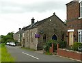
Timbersbrook Primitive Methodist Chapel
Now converted to residential use. The house nameplate indicates that the chapel was built in 1882, although the inscription in the gable is now illegible.
Image: © Alan Murray-Rust
Taken: 9 Aug 2016
0.02 miles
2
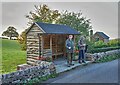
Rustic Shelter
Timbersbrook: it does not look as if a bus will be along any time soon!
Image: © Anthony O'Neil
Taken: 22 Oct 2015
0.04 miles
3
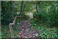
A lot of steps
Timbersbrook Country Park
Image: © Anthony O'Neil
Taken: 22 Oct 2015
0.04 miles
4
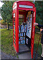
Mobile Phone?
No! Mobile Library, Timbersbrook. (Ignore the O/S Map: you will never make a call from here.)
Image: © Anthony O'Neil
Taken: 22 Oct 2015
0.05 miles

6
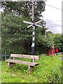
Direction Sign – Signpost at Timbersbrook
Located at Timbersbrook, on a grass triangle at the junction of Under Rainow Road, Weathercocok Lane and Tunstall Road in Congleton parish. 4 arms and pawn finial. See also http://www.geograph.org.uk/photo/5076292.
Milestone Society National ID: CH_SJ8962
Image: © W MacDonald
Taken: 5 Jul 2020
0.06 miles
7
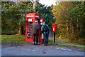
How many walkers ...
can you fit in a 'phone box?
Image: © Anthony O'Neil
Taken: 22 Oct 2015
0.06 miles
8
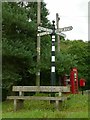
The green, Timbersbrook
Just a small triangle in the crossroads, but large enough to accommodate a seat, a fingerpost, telephone kiosk and postbox. The fingerpost is a traditional Cheshire County Council cast iron design, but the shield carries the letters BDC rather than the normal CCC. This almost certainly represents Buglawton (Urban) District Council.
The K6 telephone kiosk has like many others been converted into a book exchange.
Image: © Alan Murray-Rust
Taken: 9 Aug 2016
0.06 miles
9
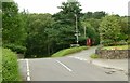
Crossroads at Timbersbrook
See http://www.geograph.org.uk/photo/5076292 for a close up of the fingerpost.
Image: © Alan Murray-Rust
Taken: 9 Aug 2016
0.06 miles
10
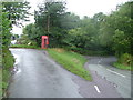
Timbersbrook
Telephone box and post box in the village centre.
Image: © Neil Lewin
Taken: 20 Aug 2006
0.07 miles