IMAGES TAKEN NEAR TO
Sheldon Avenue, CONGLETON, CW12 3LD

Introduction

This page details the photographs taken nearby to Sheldon Avenue, CW12 3LD by members of the Geograph project.

The Geograph project started in 2005 with the aim of publishing, organising and preserving representative images for every square kilometre of Great Britain, Ireland and the Isle of Man.

There are currently over 7.5m images from over14,400 individuals and you can help contribute to the project by visiting https://www.geograph.org.uk

Image Map


Images are licensed for reuse under creativecommons.org/licenses/by-sa/2.0
Notes
  • Clicking on the map will re-center to the selected point.
  • The higher the marker number, the further away the image location is from the centre of the postcode.

Image Listing (87 Images Found)

Images are licensed for reuse under creativecommons.org/licenses/by-sa/2.0
  • ...
Image
Details
Distance
1
Railway Inn, Congleton
On the other side of the railway from the Queens Head you'll find three more real beers at the Railway Inn.
Image: © al partington Taken: 23 May 2007
0.03 miles
2
North east end of Cross Lane, Congleton
Looking towards Biddulph Road.
Image: © Richard Vince Taken: 1 Jun 2019
0.03 miles
3
Elizabeth II postbox on Biddulph Road, Congleton
Postbox No. CW12 22. See Image] for context.
Image: © JThomas Taken: 30 May 2024
0.04 miles
4
Biddulph Road / Park Lane, Congleton
Showing position of Postbox No. CW12 22. See Image] for postbox.
Image: © JThomas Taken: 30 May 2024
0.05 miles
5
Road junction with pub and mill, Congleton
On the right the A527 Biddulph Road rises to cross the canal and railway. Behind the Railway Inn is H.J.Lea Oakes' animal feed mill. The colourful poster facing the main road invites you to Watch The Six Nations At The Railway.
Image: © Jonathan Hutchins Taken: 18 Mar 2017
0.06 miles
6
West end of Southlands Road, Congleton
Seen from Cross Lane.
Image: © Richard Vince Taken: 1 Jun 2019
0.06 miles
7
The Railway Inn, Congleton
Image: © Jonathan Hutchins Taken: 18 Mar 2017
0.06 miles
8
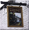
Sign for the Railway Inn
This is the sign for the Image The railway reached Congleton in 1847, several years after the canal- indeed it was almost built instead of the canal. The sign depicts a steam engine pulling rolling stock, a considerably more modern engine than the ones running in the mid 19th century.
Image: © Jonathan Kington Taken: 15 Dec 2010
0.07 miles
9
Railway Inn
Viewed from the bridge carrying the A527 over the railway and canal, the Railway Inn looks as if it is located on the old road that would have crossed the railway using a level crossing. For a close-up of the sign see Image
Image: © Jonathan Kington Taken: 15 Dec 2010
0.07 miles
10
Canal bridges in Congleton, Cheshire
This is the Macclesfied Canal, looking west as it passes through Hightown. Hightown Bridge is No 74, and carries the Morley Drive cul-de-sac, which serves the John Morley dried fruit importer warehouse. Next are the A527 flyover, and Park Lane Bridge (No 75), followed by a railway bridge, then Morris Bridge (No 76), which is a turnover bridge allowing the towpath to change sides.
Image: © Roger Kidd Taken: 9 Sep 2014
0.08 miles
  • ...