1
Buxton Road near King Street
Image: © Colin Pyle
Taken: 22 Mar 2014
0.06 miles
2
Throstles Nest
Image: © Peter McDermott
Taken: 6 Mar 2021
0.09 miles
3
Flint mill, Buglawton
Late 18th century silk mill later used as a flint grinding mill. Sandstone to ground floor with brick upper structure and five storey, five by five bays. There is an 18' waterwheel on the far side. There is an attached three storey stone range 13 bays long.
Image: © Chris Allen
Taken: 17 Feb 2019
0.10 miles
4
Dane in Shaw Brook
Dane in Shaw Brook in Congleton.
Image: © Peter McDermott
Taken: 6 Mar 2021
0.11 miles
5
Dane Shaw Mill, Buglawton
Early 19th century silk mill next to Dane in Shaw Brook. The three storey building on the left is a former engine house. The site had a rather shut down look about it.
Image: © Chris Allen
Taken: 17 Feb 2019
0.11 miles
6
Daneside Business Park
Image: © Stephen Craven
Taken: 15 Oct 2022
0.12 miles
7
St John's Church, Buglawton- War Memorial
Located in the churchyard, this memorial records the men of Buglawton who gave their lives fighting in World War I and World War II.
Image: © Jonathan Kington
Taken: 29 Aug 2011
0.17 miles
8
St John's Church, Buglawton- Churchyard
Situated on the west side of the church, the churchyard is very tidy and well looked after.
Image: © Jonathan Kington
Taken: 29 Aug 2011
0.17 miles
9
St John's Church, Buglawton- Western clockface
One of three clocks on the tower, all of which seemed to have stopped at different times. See also
Image and
Image
Image: © Jonathan Kington
Taken: 29 Aug 2011
0.20 miles
10
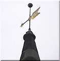
St John's Church, Buglawton- Weather vane
The weather vane is on the steeple on St John's Church.
For centuries weathervanes, or weathercocks, have kept people in touch with the elements, signalling those shifts in the wind, which bring changes in the weather. Nowadays they are typically used as an architectural ornament at the highest point of a building. Although the cockerel is the traditional design, ships, arrows, pheasants, people and horses to name but a few are also common. Weathervanes are designed in such a way that the weight is evenly distributed on each side of the surface, but the surface area is unequally divided, so that the pointer can move freely on its axis. The side with the larger surface area is blown away from the wind direction, so that the smaller side, with the pointer, turns to face the wind direction. Most vanes have pointers below that are aligned with the compass points, north, east, south and west. Because of a papal edict in the 9th century there were a great number of weathercocks to be found on churches, the edict ordered that every Church in Christendom had to be mounted with a cockerel to symbolise Peter’s betrayal of Christ (Luke 22:34- "I tell thee, Peter, the cock shall not crow this day, before that thou shalt thrice deny that thou knowest me"). Although the edict only required the cockerel to be a symbol it soon became a weathervane and by the 13th century both terms, weathercock and weathervane, were being used interchangeably. Because Christian churches are always laid out east to west early weathercocks did not need to have compass directions attached to them, although it could be a bit tricky with this church being laid NNE to SSW.
Image: © Jonathan Kington
Taken: 29 Aug 2011
0.20 miles


