IMAGES TAKEN NEAR TO
Lawton Street, CONGLETON, CW12 1GT

Introduction

This page details the photographs taken nearby to Lawton Street, CW12 1GT by members of the Geograph project.

The Geograph project started in 2005 with the aim of publishing, organising and preserving representative images for every square kilometre of Great Britain, Ireland and the Isle of Man.

There are currently over 7.5m images from over14,400 individuals and you can help contribute to the project by visiting https://www.geograph.org.uk

Image Map


Images are licensed for reuse under creativecommons.org/licenses/by-sa/2.0
Notes
  • Clicking on the map will re-center to the selected point.
  • The higher the marker number, the further away the image location is from the centre of the postcode.

Image Listing (93 Images Found)

Images are licensed for reuse under creativecommons.org/licenses/by-sa/2.0
  • ...
Image
Details
Distance
1
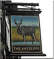
The sign for The Antelope
This is the sign for Image at the top of Lawton Street. Originally this animal would have been painted a little more flamboyantly, with a mane, a long tail and looking fawn-like so that they appeared more heraldic. More modern sign painters, however, prefer to depict them in a more natural stance. The antelope, and sometimes just the antelope's head, has long been associated with heraldry and appears in many coats of arms and emblems, including royal ones such as Henry V and Henry VI. My grateful thanks to Trish Steel ( http://www.geograph.org.uk/profile/9274 ) for her help in the research for this.
Image: © Jonathan Kington Taken: 17 Nov 2010
0.02 miles
2
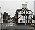
The Antelope
Located at the top of Lawton Street in Congleton, this picture was taken looking across the very busy road junction near Mountbatten Way. For more information on the name and a close up of the sign see Image For another, similar view of see Image
Image: © Jonathan Kington Taken: 17 Nov 2010
0.02 miles
3
The Beartown Cock, Congleton
Image: © Jonathan Hutchins Taken: 18 Mar 2017
0.02 miles
4
Top of Lawton Street
Taken from its junction near the end of Mountbatten Way and looking towards Congleton town centre, for another view of the pub see Image
Image: © Jonathan Kington Taken: 17 Nov 2010
0.02 miles
5
Well Pharmacy, Park Lane, Congleton
Image: © Jonathan Hutchins Taken: 18 Mar 2017
0.04 miles
6
League of Friends Charity Shop, Congleton
Sited at 55A Lawton Street.
Image: © Jonathan Hutchins Taken: 18 Mar 2017
0.04 miles
7
Road junction in Congleton
Junction of Mountbatten Way (ahead) and Bromley Road (left).
Image: © Trevor Harris Taken: 28 Jul 2017
0.04 miles
8
43 Lawton Street, Congleton
Currently (March 2017) home to Cheshire Colonics, a colonic hydrotherapy clinic, this 17th century timber-framed building is Grade II listed. See list entry at https://www.historicengland.org.uk/listing/the-list/list-entry/1130467
Image: © Jonathan Hutchins Taken: 18 Mar 2017
0.06 miles
9
Wallworths Bank, Congleton
Image: © Jonathan Hutchins Taken: 18 Mar 2017
0.06 miles
10
Park Mill, Congleton
A former silk mill built in 1825 by Charles Townley. Three storeys and 16 bays, brick built with a rendered front. Extensively rebuilt as accommodation in the late twentieth century. Although it has not been spoilt with balconies, you could be forgiven for not realising it was a nearly two hundred year old silk mill,
Image: © Chris Allen Taken: 17 Feb 2019
0.06 miles
  • ...