IMAGES TAKEN NEAR TO
Mountbatten Way, CONGLETON, CW12 1DN

Introduction

This page details the photographs taken nearby to Mountbatten Way, CW12 1DN by members of the Geograph project.

The Geograph project started in 2005 with the aim of publishing, organising and preserving representative images for every square kilometre of Great Britain, Ireland and the Isle of Man.

There are currently over 7.5m images from over14,400 individuals and you can help contribute to the project by visiting https://www.geograph.org.uk

Image Map


Images are licensed for reuse under creativecommons.org/licenses/by-sa/2.0
Notes
  • Clicking on the map will re-center to the selected point.
  • The higher the marker number, the further away the image location is from the centre of the postcode.

Image Listing (182 Images Found)

Images are licensed for reuse under creativecommons.org/licenses/by-sa/2.0
  • ...
Image
Details
Distance
1
Fair Mill, Congleton
On Worrall Street, a fustian cutting mill of the 1870s, one bay by 21 bays. Now converted.
Image: © Chris Allen Taken: 17 Feb 2019
0.01 miles
2
Worrall Street, Congleton
Works in Worrall Street.
Image: © Trevor Harris Taken: 28 Jul 2017
0.01 miles
3
Congleton Learning Centre
Image: © nick macneill Taken: 1 Sep 2011
0.02 miles
4
Building on the site of Meadow Mills, Congleton
The big red brick multistorey building incorporated the name stone of Meadow Mills but is obviously a total reconstruction. The original mill was built in 1860 as a silk throwing mill but later converted to fustian cutting. Apparently the rear western single storey brick workshop survives. My guess is that this is now Soapy Joes car wash.
Image: © Chris Allen Taken: 17 Feb 2019
0.02 miles
5
Riverside Mill, Congleton
Fustian cutting mil built 1878-1887. The central gabled bay and the clock tower are both convincing but are late twentieth century additions. The mill is L shaped. It is now converted to offices. Congleton still retains many mills and many have been converted to apartments or offices, most quite tastefully.
Image: © Chris Allen Taken: 17 Feb 2019
0.04 miles
6
Riverside offices
Formerly a cigar manufacturing mill built at the beginning of the 20th century, this fine building now houses offices. For a close-up of the clock tower on the roof see Image
Image: © Jonathan Kington Taken: 20 Mar 2011
0.05 miles
7
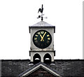
Clock and weathervane on Riverside
This clock with the weathervane above are mounted on the roof of Image, although the weathervane still worked the clock seems to have long stopped. For centuries weathervanes, or weathercocks, have kept people in touch with the elements, signalling those shifts in the wind, which bring changes in the weather. Nowadays they are typically used as an architectural ornament at the highest point of a building. Although the cockerel is the traditional design, ships, arrows, pheasants, people and horses to name but a few are also common. Weathervanes are designed in such a way that the weight is evenly distributed on each side of the surface, but the surface area is unequally divided, so that the pointer can move freely on its axis. The side with the larger surface area is blown away from the wind direction, so that the smaller side, with the pointer, turns to face the wind direction. Most vanes have pointers below that are aligned with the compass points, north, east, south and west. Because of a papal edict in the 9th century there were a great number of weathercocks to be found on churches, the edict ordered that every Church in Christendom had to be mounted with a cockerel to symbolise Peter’s betrayal of Christ (Luke 22:34- "I tell thee, Peter, the cock shall not crow this day, before that thou shalt thrice deny that thou knowest me"). Although the edict only required the cockerel to be a symbol it soon became a weathervane and by the 13th century both terms, weathercock and weathervane, were being used interchangeably. Because Christian churches are always laid out east to west early weathercocks did not need to have compass directions attached to them.
Image: © Jonathan Kington Taken: 20 Mar 2011
0.05 miles
8
Shepherd's Mill, Worrall Street, Congleton
This brick built fustian cutting mill is now the offices of Plus Dane Housing and has been heavily altered. It was built in the 1870s and was 24 by one bays but is now only 20 bays long.
Image: © Chris Allen Taken: 17 Feb 2019
0.05 miles
9
Soapy Joe's
Soapy Joe's hand car wash is situated on the corner of Mountbatten Way (A54) and Worrall Street in Congleton.
Image: © Jonathan Kington Taken: 27 May 2010
0.07 miles
10
Congleton Police Station
In Market Square: http://www.cheshire.police.uk/my-neighbourhood/congleton.aspx
Image: © Mike Faherty Taken: 28 Dec 2014
0.08 miles
  • ...