
IMAGES TAKEN NEAR TO
Bailey Crescent, SANDBACH, CW11 2LA
Introduction
This page details the photographs taken nearby to Bailey Crescent, CW11 2LA by members of the Geograph project.
The Geograph project started in 2005 with the aim of publishing, organising and preserving representative images for every square kilometre of Great Britain, Ireland and the Isle of Man.

There are currently over 7.5m images from over14,400 individuals and you can help contribute to the project by visiting https://www.geograph.org.uk
Image Map
Images are licensed for reuse under creativecommons.org/licenses/by-sa/2.0
Notes
- Clicking on the map will re-center to the selected point.
- The higher the marker number, the further away the image location is from the centre of the postcode.
Image Listing (10 Images Found)
Images are licensed for reuse under creativecommons.org/licenses/by-sa/2.0
Image
Details
Distance
1
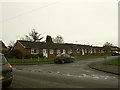
Bailey Crescent, Sandbach
A mixture of single- and two-storey housing.
Image: © Stephen Craven
Taken: 1 Jan 2016
0.03 miles
2
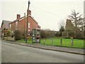
Phone box and footpath
Thanks to Open Street Map I can identify the public footpath that starts here as local footpath number 16. It leads to Manor Road. There is a modern style phone box at this end on Heath Road.
Image: © Stephen Craven
Taken: 1 Jan 2016
0.05 miles
3
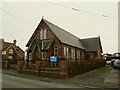
Sandbach Heath Methodist Church
Unlike the established church, whose place of worship is half a mile outside the village, the Methodists have theirs in the village centre.
Image: © Stephen Craven
Taken: 1 Jan 2016
0.06 miles
4
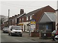
Heath Road Garage, Sandbach
A MOT testing station. Beyond it is a Premier convenience store.
Image: © Stephen Craven
Taken: 1 Jan 2016
0.13 miles
5
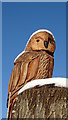
'Snowy owl' by School Ln, Sandbach Heath
Image: © Colin Park
Taken: 11 Dec 2017
0.16 miles
6
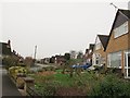
Hawthorne Drive, Sandbach
Viewed from the Heath Road end.
Image: © Stephen Craven
Taken: 1 Jan 2016
0.19 miles
7
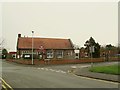
Sandbach Heath school
St John's Church of England Primary School, on Heath Road. This single form entry school was built in memory of the Revd John Armitstead (former Vicar of Sandbach) and was open by 1899. (Information from Stewart Green's online history of Sandbach).
Image: © Stephen Craven
Taken: 1 Jan 2016
0.19 miles
8
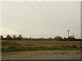
Arable land at Heath Farm
The tower of St Mary's church, Sandbach can be seen in the distance.
Image: © Stephen Craven
Taken: 1 Jan 2016
0.23 miles
9
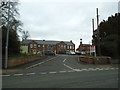
New entrance to Hill House
Hill House is a Leonard Cheshire home, providing a range of services for adults with physical disabilities. This vehicular entrance off The Hill provides a more direct route into the grounds than previously.
Image: © Stephen Craven
Taken: 19 Mar 2017
0.24 miles
10
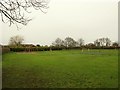
Sandbach Heath recreation ground
There is a football pitch and small children's playground.
Image: © Stephen Craven
Taken: 1 Jan 2016
0.24 miles