1
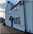
Road junction, Middlewich
Junction of St Ann's Road and Queen Street.
Image: © Jonathan Hutchins
Taken: 18 Mar 2017
0.04 miles
2
Hannah's Walk, Middlewich
Hannah's Walk is a public footpath designated Middlewich FP 8 and runs between St Ann's Road and the Shropshire Union Canal.
Image: © Jonathan Hutchins
Taken: 18 Mar 2017
0.06 miles
3
Middlewich High School, Queen Street
Carved in relief above the two bricked up doorways at each end of the front of the school, reads 'Junior Boys' on the left, and 'Junior Girls' on the right. For more information on the school see http://schoolsfinder.direct.gov.uk/8954127/overview/?d=1&Specialism=0&searchstring=middlewich&PC=CW10%209BU&type=Primary%2CSecondary&d=1&distanceMeasure=miles&distanceValue=5&pagetype=search-results
Image: © David P Howard
Taken: 13 Oct 2010
0.07 miles
4
Middlewich Council School
The school was opened in 1906. In 1979 it became the Middlewich County Comprehensive.
Image: © Jonathan Hutchins
Taken: 18 Mar 2017
0.07 miles
5
Middlewich High School, King Edward Street - detail (1)
The original building of 1906 bears the name 'Council School'. See
Image for context.
Image: © Stephen Craven
Taken: 28 Aug 2022
0.07 miles
6
Middlewich High School, King Edward Street - detail (1)
The foundation stone in inscribed granite is not easy to read but the wording seems to be:
'This foundation stone was laid on the third day of January 1906 by Colonel Charles Hosken France Hayhurst DL JP of Bostock Hall Middlewich Chairman of the Administrative Sub-Committee for the Winsford and Middlewich District Appointed by the Cheshire County Education Committee'.
Bostock Hall still exists and its website includes a brief biography of the above: 'Charles Hosken France-Hayhurst (1832-1914) served in the 17th Regiment in the Crimea becoming Lieutenant Colonel of the 1st Royal Cheshire Militia: he was Sheriff of Cheshire in 1879.'
Image: © Stephen Craven
Taken: 28 Aug 2022
0.07 miles
7
Middlewich, St Ann's Road
According to the OS benchmark database there is a benchmark cut into the north-west facing wall of this property. The mark should be located behind the litter bin, but the render and masonry paint is masking any markings. Nothing was found.
Image: © Mel Towler
Taken: 8 Oct 2022
0.09 miles
8
65 St Ann's Road, Middlewich
This house is one of the oldest on the road, and appears on the 1908 map, at a time when the road name was spelled St Anne's (the 'e' has since been dropped).
Image: © Stephen Craven
Taken: 28 Aug 2022
0.09 miles
9
Middlewich, Middlewich High School
The benchmark is cut into the 7th and 8th courses on a north west face on the east side of King Edward Street.
Image: © Mel Towler
Taken: 8 Oct 2022
0.09 miles
10
Middlewich, Middlewich High School
There is a benchmark cut into the 7th and 8th courses of bricks on the north west face on the east side of King Edward Street. The cutmark can be located between the tree and the drainpipe in this photo.
Image: © Mel Towler
Taken: 8 Oct 2022
0.09 miles


