IMAGES TAKEN NEAR TO
Brooks Lane, MIDDLEWICH, CW10 0QG
Introduction
This page details the photographs taken nearby to Brooks Lane, CW10 0QG by members of the Geograph project.
The Geograph project started in 2005 with the aim of publishing, organising and preserving representative images for every square kilometre of Great Britain, Ireland and the Isle of Man.

There are currently over 7.5m images from over14,400 individuals and you can help contribute to the project by visiting https://www.geograph.org.uk
Image Map
Images are licensed for reuse under creativecommons.org/licenses/by-sa/2.0
Notes
- Clicking on the map will re-center to the selected point.
- The higher the marker number, the further away the image location is from the centre of the postcode.
Image Listing (186 Images Found)
Images are licensed for reuse under creativecommons.org/licenses/by-sa/2.0
Image
Details
Distance
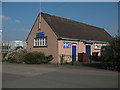
2
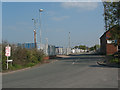
Road Beta, Middlewich
The unusually named road is part of a small business park.
The tyre marks in the foreground show that HGVs all come from along Brooks Lane from the left. Although it is much nearer to the main road the other way, that involves going over a hump-backed bridge Image
Image: © Stephen Craven
Taken: 19 Apr 2009
0.06 miles
3
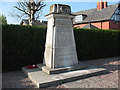
War memorial, Brooks Lane, Middlewich
The memorial inscription above the list of names reads "TO THE GLORIOUS MEMORY OF THE MEN FROM THESE WORKS WHO FELL IN THE GREAT WAR 1914 - 1919" with a further addition for WW2. The name of "these works" is not stated but the UKNIWM entry http://www.ukniwm.org.uk (ref. 42850) reveals it to be Brunner, Mond & Co.
According to Historic England, this memorial was one of several designed for the company by Thomas Arthur Darcy Braddell (1884-1970) at their sites in Silvertown, Winnington, Lostock, Sandbach and Middlewich, and the Mond Mausoleum at St Pancras and Islington Cemetery. Source: https://historicengland.org.uk/listing/the-list/list-entry/1452765?section=official-list-entry
Image: © Stephen Craven
Taken: 19 Apr 2009
0.07 miles
4

Murgatroyd's brine pump, Middlewich
This is a Scheduled Ancient Monument and is the only intact wild brine pumping plant over a hand dug shaft in the UK. It dates from 1889 and originally was pumped by steam power and supplied an open pan salt works that was immediately adjacent. It later pumped brine to a chemical works near Sandbach where the brine was electrolysed to produce chlorine, sodium hydroxide and hydrogen. The pumps were later electrically driven and the well was used until 1977 when wild brine pumping stopped due to subsidence. The chemical works near Sandbach were demolished in 2010. This excellent little museum is open one weekend per month in the summer.
This is inside the pumphouse with pump No. 1 closest to the camera and pump No. 3 behind it. (Pump No. 2 was in a separate building.) The pump is by John Thom of Patricroft and the motor is by Mather and Platt.
Image: © Chris Allen
Taken: 11 May 2025
0.08 miles
5

Murgatroyd's brine pump, Middlewich
This is a Scheduled Ancient Monument and is the only intact wild brine pumping plant over a hand dug shaft in the UK. It dates from 1889 and originally was pumped by steam power and supplied an open pan salt works that was immediately adjacent. It later pumped brine to a chemical works near Sandbach where the brine was electrolysed to produce chlorine, sodium hydroxide and hydrogen. The pumps were later electrically driven and the well was used until 1977 when wild brine pumping stopped due to subsidence. The chemical works near Sandbach were demolished in 2010. This excellent little museum is open one weekend per month in the summer.
Image: © Chris Allen
Taken: 11 May 2025
0.08 miles
6

Middlewich Dry Dock
Trent and Mersey Canal, just below Middlewich Top Lock 72
Image: © Mike Todd
Taken: 13 May 2011
0.09 miles
7
Trent and Mersey Canal: Middlewich Top Lock No 72
Image: © Dr Neil Clifton
Taken: 2 Apr 2015
0.09 miles
8
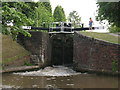
Lock no 72 at Middlewich
The top one of a flight of three locks on the Trent & Mersey Canal. The paddles have just been opened to lower a boat, causing a visible surge in the water level in the short stretch of water around the bend to the middle lock Image
Image: © Stephen Craven
Taken: 27 Jun 2010
0.09 miles
9
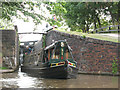
Emerging from the lock
A narrowboat emerges from the lock after the water level has been lowered - see Image
Image: © Stephen Craven
Taken: 27 Jun 2010
0.09 miles