IMAGES TAKEN NEAR TO
Orton Lane, ATHERSTONE, CV9 3RR
Introduction
This page details the photographs taken nearby to Orton Lane, CV9 3RR by members of the Geograph project.
The Geograph project started in 2005 with the aim of publishing, organising and preserving representative images for every square kilometre of Great Britain, Ireland and the Isle of Man.

There are currently over 7.5m images from over14,400 individuals and you can help contribute to the project by visiting https://www.geograph.org.uk
Image Map
Images are licensed for reuse under creativecommons.org/licenses/by-sa/2.0
Notes
- Clicking on the map will re-center to the selected point.
- The higher the marker number, the further away the image location is from the centre of the postcode.
Image Listing (13 Images Found)
Images are licensed for reuse under creativecommons.org/licenses/by-sa/2.0
Image
Details
Distance
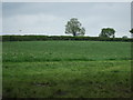
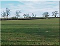
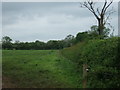
1
Crop field and hedgerow
West of Twycross Road.
Image: © JThomas
Taken: 23 May 2015
0.11 miles
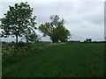
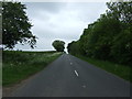
2
Field from B4116
Between Twycross (where the zoo is) and Sheepy Magna. The Cross Hands is not in the running when it comes to names in this area of Leicestershire.
Image: © Ken Brockway
Taken: 28 Apr 2007
0.12 miles

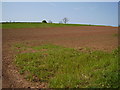
5
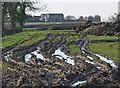
Muddy fields alongside the B4116 Twycross Road
The buildings in the distance are part of Hill Farm.
Image: © Mat Fascione
Taken: 9 Feb 2008
0.18 miles
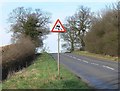
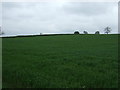
9
Hedgerow and field
East of Twycross Road (B4116).
Image: © JThomas
Taken: 23 May 2015
0.19 miles