
IMAGES TAKEN NEAR TO
Bentley Common, ATHERSTONE, CV9 2HL
Introduction
This page details the photographs taken nearby to Bentley Common, CV9 2HL by members of the Geograph project.
The Geograph project started in 2005 with the aim of publishing, organising and preserving representative images for every square kilometre of Great Britain, Ireland and the Isle of Man.

There are currently over 7.5m images from over14,400 individuals and you can help contribute to the project by visiting https://www.geograph.org.uk
Image Map
Images are licensed for reuse under creativecommons.org/licenses/by-sa/2.0
Notes
- Clicking on the map will re-center to the selected point.
- The higher the marker number, the further away the image location is from the centre of the postcode.
Image Listing (14 Images Found)
Images are licensed for reuse under creativecommons.org/licenses/by-sa/2.0
Image
Details
Distance
1
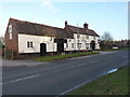
The Horse and Jockey at Bentley
A roadside pub on the B4116
Image: © Richard Law
Taken: 11 Jan 2017
0.01 miles
2
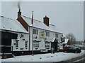
The Horse and Jockey, Bentley
I'm delighted to see that this distinctly isolated pub is still going strong. Back 30+ years ago, you used to have to walk up a garden path behind the pub to use the gents. There are no other buildings next to it, and only a very few within a mile's radius. Bentley Park Wood is on the opposite side of the road, see Image]
Image: © Rob Farrow
Taken: 23 Mar 2013
0.01 miles
3
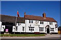
The Horse and Jockey at Bentley Common
The sign says "New Chef, Andrea" let's hope she is a good one.
Image: © Mick Malpass
Taken: 1 Apr 2012
0.03 miles
4
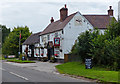
The Horse & Jockey at Bentley
A public house along the B4116, opposite Bentley Park Wood.
Image: © Mat Fascione
Taken: 13 Sep 2015
0.03 miles
5
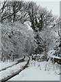
Snowy track into Bentley Park Wood
This track and public bridleway leads off the B4116 into Bentley Park Wood. It is almost opposite Image]
Image: © Rob Farrow
Taken: 23 Mar 2013
0.04 miles
6
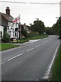
The Jockey at Bentley
Bentley appears to be a pub, a graveyard and a farm....
Image: © Richard Harrison
Taken: 30 Oct 2005
0.07 miles
7
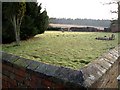
Cemetery, Bentley
A sparsely populated and rather desolate cemetery ... with no church.
On the 1940s map a church with a tower is shown here, it is also shown on my old green 1:25000 Nuneaton map which was updated in the mid 60s, so presumably it was demolished in the last 40 years. I wonder when.
[April '06] I've got as far as discovering that the church was dedicated to St.John.
According to the GENUKI website, the church was built in 1837, and as the Christening registers continue until 1967, perhaps it was demolished soon after this date. Here's a link to the GENUKI site.
http://www.bmsgh.org/parish/warw/tyaiw/bentley.html
Image: © Rob Farrow
Taken: 22 Jan 2006
0.09 miles
8
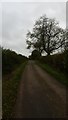
Minor road
A single track minor road near to Bentley.
Image: © Peter Mackenzie
Taken: 23 Oct 2017
0.13 miles
9
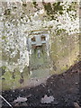
OS flush bracket - Bentley Park Wood trig
Flush Bracket S3050, which is affixed to the base of the trig in the centre of the field. Its benchmark (or rather more accurately the rivet inside the trig) is taken to be 174.241m above Ordnance Datum Newlyn.
Image: © Richard Law
Taken: 11 Jan 2017
0.17 miles
10
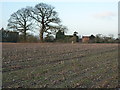
Trig point and Epps Farm
In the middle of the field of cropped maize, just to the right of the twin oak trees, lies Bentley Park Wood trig at 174.241m above Ordnance Datum Newlyn.
Image: © Richard Law
Taken: 11 Jan 2017
0.17 miles