
IMAGES TAKEN NEAR TO
St. Johns Courtyard, Station Street, ATHERSTONE, CV9 1EZ
Introduction
This page details the photographs taken nearby to St. Johns Courtyard, Station Street, CV9 1EZ by members of the Geograph project.
The Geograph project started in 2005 with the aim of publishing, organising and preserving representative images for every square kilometre of Great Britain, Ireland and the Isle of Man.

There are currently over 7.5m images from over14,400 individuals and you can help contribute to the project by visiting https://www.geograph.org.uk
Image Map
Images are licensed for reuse under creativecommons.org/licenses/by-sa/2.0
Notes
- Clicking on the map will re-center to the selected point.
- The higher the marker number, the further away the image location is from the centre of the postcode.
Image Listing (225 Images Found)
Images are licensed for reuse under creativecommons.org/licenses/by-sa/2.0
Image
Details
Distance
1
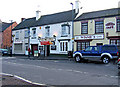
The White Lion, Station Street
This has been a pub certainly since around 1817, possibly earlier. They are fond of lions in this area. Atherstone has this White Lion, plus the Red Lion Hotel and nearby at Witherley is the Blue Lion Inn.
Next door to The White Lion, on the left, is Atherstone House, a Chinese Take Away. On the other side is Winnie's Cafe.
Image: © P L Chadwick
Taken: 28 Dec 2009
0.01 miles
2

South side of Station Street, Atherstone
The buildings are shown on the large-scale OS map surveyed in 1887.
Image: © Christine Johnstone
Taken: 5 Jun 2025
0.02 miles
3
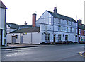
The Lounge, 53 Station Street
Judging by the outside appearance, this has probably been a public house for a very long time. Today it is called The Lounge and on the outside it says it is a "bar venue". Previously it was The Blue Dog, and prior to that it was Branagans Bar. Possibly it has had other names, or maybe The Blue Dog was its original name.
There is a local group of keen young drinkers called the Atherstone Binge Drinking Society, which probably tells you all you need to know. The Lounge was one of the pubs they selected for a Boxing Day pub crawl. It must have felt quite honoured, as they have an awful lot of pubs in Atherstone to chose from!
Image: © P L Chadwick
Taken: 28 Dec 2009
0.03 miles
4
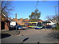
Atherstone bus station
Atherstone bus station is the rather grand title given to this large turning circle with a very long bus shelter, located on the north side of Station Street in the town centre. The bus is an Alexander Dennis Enviro 200, operated by Stagecoach in Warwickshire on route 48 to Coventry via Nuneaton.
Image: © Richard Vince
Taken: 2 Feb 2013
0.04 miles
5
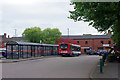
Atherstone Bus Station
A Stagecoach bus awaits departure from the row of shelters that constitute Atherstone's bus station on the 41 route to Nuneaton via Ansley Common.
Image: © Stephen McKay
Taken: 9 Sep 2020
0.04 miles
6

Re-used chapel, Coleshill Road, Atherstone
This chapel is described as disused on the large-scale OS map surveyed in 1887. Some maps now show it as 'The Partnership Centre', and the boxes numbered 4, 5 and 6 suggest there are now multiple users.
Image: © Christine Johnstone
Taken: 5 Jun 2025
0.04 miles
7
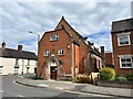
Former Independent Chapel, Coleshill Street West, Atherstone
Opened on 27 March 1856.
Image: © Andrew Abbott
Taken: 1 May 2023
0.05 miles
8
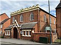
Trinity Church, Atherstone
Grade II listed. Listing number 1365147.
Image: © Andrew Abbott
Taken: 1 May 2023
0.05 miles
9

Trinity Church, Coleshill Road, Atherstone
Grade II listed, built in the early 1800s, with later additions. The notices imply that it is used by the United Reformed Church, the Methodists and the Warwickshire Community and Voluntary Action organisation [CAVA].
Image: © Christine Johnstone
Taken: 5 Jun 2025
0.05 miles
10
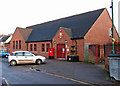
Royal Mail Atherstone Delivery Office, Coleshill Street
The postal address is Long Street, but the office actually fronts onto Coleshill Street.
Image: © P L Chadwick
Taken: 28 Dec 2009
0.06 miles