
IMAGES TAKEN NEAR TO
Waverley Edge, COVENTRY, CV8 3LW
Introduction
This page details the photographs taken nearby to Waverley Edge, CV8 3LW by members of the Geograph project.
The Geograph project started in 2005 with the aim of publishing, organising and preserving representative images for every square kilometre of Great Britain, Ireland and the Isle of Man.

There are currently over 7.5m images from over14,400 individuals and you can help contribute to the project by visiting https://www.geograph.org.uk
Image Map
Images are licensed for reuse under creativecommons.org/licenses/by-sa/2.0
Notes
- Clicking on the map will re-center to the selected point.
- The higher the marker number, the further away the image location is from the centre of the postcode.
Image Listing (14 Images Found)
Images are licensed for reuse under creativecommons.org/licenses/by-sa/2.0
Image
Details
Distance
1
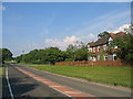
Waverley crossroads
Looking north along the Leamington - Leicester road.
Image: © David Stowell
Taken: 14 Jul 2005
0.07 miles
2
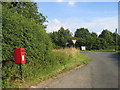
Waverley crossroads
The postbox and roadsigns, seen approaching the crossroads from the Bubbenhall direction.
Image: © David Stowell
Taken: 14 Jul 2005
0.07 miles
4
Weston Lane going away from Waverley Crossroads
Image: © Keith Williams
Taken: 21 Apr 2009
0.09 miles
5
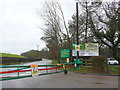
Entrance to Waverley Wood Site
This is a large site that houses a quarry and a waste disposal landfill site. It appears to be owned by Smiths Concrete who supply sand and gravel aggregates.It also has the Bubbenhall Landfill site , sometimes known as Glebe Farm PPC.
The site is also of scientific interest because of the archaeological finds made here. It is an important reserve of an interglacial deposit, preserved
beneath a local drift sequence. The interglacial beds occupy a
channel cut in Mercia Mudstone bedrock. They are overlain by the Baginton-Beds sequence. In the interglacial sediments have been found
plant remains such as pollen, and molluscs, vertebrate, and
insect remains. The deposits are of high interest in establishing the sequence of glacial events within the British Isles and how this is related to Human occupation of which there is also evidence from the site. Stone tools, including four handaxes found at the site, are among the oldest found in Britain. These axes and other finds are on permanent display at the Warwickshire Museum.
Image: © Nigel Mykura
Taken: 4 Mar 2012
0.11 miles
8
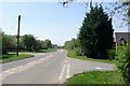
The A445 through Waverley crossroads
Image: © Keith Williams
Taken: 21 Apr 2009
0.13 miles
9
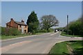
The A445 through Waverley crossroads
Image: © Keith Williams
Taken: 21 Apr 2009
0.15 miles
10
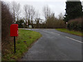
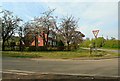
Watery Lane
Looking towards the junction with the A445 south-west of Bubbenhall. This seems an odd location for a post box but there are a few buildings around.
Image: © Stephen McKay
Taken: 23 Jan 2018
0.16 miles