
IMAGES TAKEN NEAR TO
Nicholas Everton Close, COVENTRY, CV8 3GF
Introduction
This page details the photographs taken nearby to Nicholas Everton Close, CV8 3GF by members of the Geograph project.
The Geograph project started in 2005 with the aim of publishing, organising and preserving representative images for every square kilometre of Great Britain, Ireland and the Isle of Man.

There are currently over 7.5m images from over14,400 individuals and you can help contribute to the project by visiting https://www.geograph.org.uk
Image Map
Images are licensed for reuse under creativecommons.org/licenses/by-sa/2.0
Notes
- Clicking on the map will re-center to the selected point.
- The higher the marker number, the further away the image location is from the centre of the postcode.
Image Listing (59 Images Found)
Images are licensed for reuse under creativecommons.org/licenses/by-sa/2.0
Image
Details
Distance
1
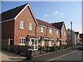
Avondale Road, Brandon
This area of the village has recently seen this new housing development. The boundary of the square cuts through the right hand end of this block of houses.
Image: © David Stowell
Taken: 16 Aug 2005
0.01 miles
2
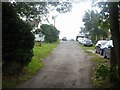
Path leaves the road
The track gives access to a couple of properties and is also the start of a public footpath that cuts the corner of a bend in Rugby Road, A428.
Image: © Michael Dibb
Taken: 21 Jul 2019
0.07 miles
3
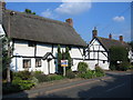
Brandon
Old thatched cottages on the Rugby Road.
Image: © David Stowell
Taken: 16 Aug 2005
0.07 miles
4
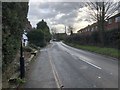
A428, Brandon Village
The A428 road passing through Brandon.
Image: © David Robinson
Taken: 27 Jan 2019
0.08 miles

6
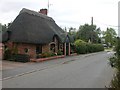
Brandon-Avondale Road
A small thatched cottage on this one-way street.
Image: © Ian Rob
Taken: 2 Sep 2007
0.09 miles
7
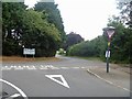
Village junction
Avondale Road, behind the camera, makes a junction with Rugby Road, A428, on this sharp bend.
Image: © Michael Dibb
Taken: 21 Jul 2019
0.09 miles
8
![Brandon Houses [15]](https://s1.geograph.org.uk/geophotos/06/27/12/6271225_15518ffc_120x120.jpg)
Brandon Houses [15]
Ivy House Farmhouse is 17th century, partly rebuilt in the 19th century and added to then and in the 20th century. Listed, grade II, with details at: https://historicengland.org.uk/listing/the-list/list-entry/1034903
Image: © Michael Dibb
Taken: 21 Jul 2019
0.10 miles

10
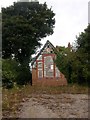
Brandon-Main Street
The Old School building, closed for many years. The clock stopped at "hometime"?
Image: © Ian Rob
Taken: 2 Sep 2007
0.10 miles