
IMAGES TAKEN NEAR TO
Bubbenhall Road, COVENTRY, CV8 3BB
Introduction
This page details the photographs taken nearby to Bubbenhall Road, CV8 3BB by members of the Geograph project.
The Geograph project started in 2005 with the aim of publishing, organising and preserving representative images for every square kilometre of Great Britain, Ireland and the Isle of Man.

There are currently over 7.5m images from over14,400 individuals and you can help contribute to the project by visiting https://www.geograph.org.uk
Image Map
Images are licensed for reuse under creativecommons.org/licenses/by-sa/2.0
Notes
- Clicking on the map will re-center to the selected point.
- The higher the marker number, the further away the image location is from the centre of the postcode.
Image Listing (9 Images Found)
Images are licensed for reuse under creativecommons.org/licenses/by-sa/2.0
Image
Details
Distance
1
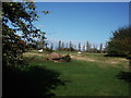
Field adjacent to Bubbenhall Road
Looking towards the Alvis test track (marked by the line of tall poplar trees)
The same view as Image]
Image: © John Brightley
Taken: 11 Sep 2011
0.04 miles
2
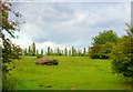
Countryside near Baginton
This field contained a large rock which appeared to be of local red sandstone. This stone was much used in Kenilworth and Coventry as a building stone for hundreds of years.
Image: © Nigel Mykura
Taken: 18 Aug 2010
0.07 miles
3
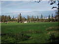
Looking across fields towards Middlemarch Business Park
The line of tall poplar trees marks the area of the Alvis test track.
Image: © John Brightley
Taken: 11 Sep 2011
0.07 miles
4
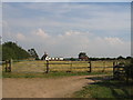
Barnfield, Baginton
One of several establishments in the area associated with horse riding and stabling.
Image: © David Stowell
Taken: 14 Jul 2005
0.14 miles
5
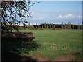
Looking across fields towards Middlemarch Business Park
I believe the large building in the background is the Parcelforce depot.
Image: © John Brightley
Taken: 11 Sep 2011
0.18 miles
6
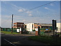
Old Alvis site, Baginton
These buildings were associated with the former Alvis test track, located near Baginton Airfield. The area now called known as the Alvis business park and is still used by companies working in servicing and maintaining aircraft.
Image: © David Stowell
Taken: 14 Jul 2005
0.19 miles
7
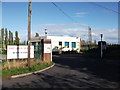
The Alvis Works, Bubbenhall Road, Baginton
Also see Image]
Image: © John Brightley
Taken: 11 Sep 2011
0.22 miles
8
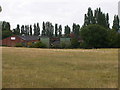
Baginton-Alvis Business Park
Old works near the airport.
Image: © Ian Rob
Taken: 7 Aug 2010
0.24 miles
9
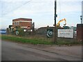
The Alvis Works Business Park
Little remains of the buildings once associated with the Alvis works and test track on Bubbenhall Road. The area south of Coventry Airport, including a former sewage works, is being redeveloped as part of the Gateway South development of an industrial and logistics estate plus country park. The remaining building in this photo is of a style akin to the former Alvis main building in Holyhead Road, Coventry.
In 2005: Image
and 2011: Image
Image: © E Gammie
Taken: 6 Nov 2020
0.24 miles