
IMAGES TAKEN NEAR TO
Trentham Gardens, KENILWORTH, CV8 2NW
Introduction
This page details the photographs taken nearby to Trentham Gardens, CV8 2NW by members of the Geograph project.
The Geograph project started in 2005 with the aim of publishing, organising and preserving representative images for every square kilometre of Great Britain, Ireland and the Isle of Man.

There are currently over 7.5m images from over14,400 individuals and you can help contribute to the project by visiting https://www.geograph.org.uk
Image Map
Images are licensed for reuse under creativecommons.org/licenses/by-sa/2.0
Notes
- Clicking on the map will re-center to the selected point.
- The higher the marker number, the further away the image location is from the centre of the postcode.
Image Listing (36 Images Found)
Images are licensed for reuse under creativecommons.org/licenses/by-sa/2.0
Image
Details
Distance
1
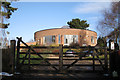
From reservoir to residential, Crew Lane
Image: © Robin Stott
Taken: 17 Jan 2010
0.08 miles
2
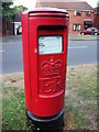
1970s style post box, Rawnsley Drive, Kenilworth
Postbox number CV8 465.
Image: © John Brightley
Taken: 4 Jul 2010
0.09 miles
3
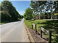
Kenilworth ? Glasshouse Lane ends here
The road continues as Knowle Hill, descending to meet Dalehouse Lane near Common Lane. In the right background is Denewood Way.
Image: © Robin Stott
Taken: 27 May 2022
0.09 miles
4
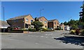
Hidcote Road, Kenilworth
Hidcote Road is a short residential road between Rawnsley Drive (foreground) and Knowle Hill. Hidcote is a much-admired plantsman's garden at the National Trust's Hidcote Manor in north Gloucestershire. Rawnsley Drive remembers Andrew Rawnsley, a leading Kenilworth councillor.
Image: © Robin Stott
Taken: 27 May 2022
0.09 miles
5
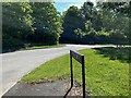
Junction of Knowle Hill, Hidcote Road and Crewe Lane, Kenilworth
Crewe or Crew Lane is ahead, centre. It runs for 1.4 km down past Kenilworth Golf Club and under the A46 to meet the B4115 near Crewe Farm.
Image: © Robin Stott
Taken: 27 May 2022
0.10 miles
6
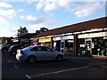
Row of shops at Leyes Lane, Kenilworth
From the left: Tesco Express (the only Tesco in the town); The Bakers Dozen bakery; AK Fitted Interiors; Lighting Inspirations. The Tesco was surprisingly busy on the Sunday evening that I took this photo.
This small parade of shops was built at the same time as the surrounding housing estate - planning permission was granted in 1985. The area is known as the Knights Meadow estate, though you won't find this name on any maps.
Image: © John Brightley
Taken: 4 Jul 2010
0.12 miles
7
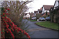
Fairway Rise off Knowle Hill, Kenilworth
Image: © Robin Stott
Taken: 17 Jan 2010
0.13 miles
9
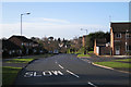
Rawnsley Drive, Kenilworth
Named after a long-serving local councillor. On the right is Framlingham Grove.
Image: © Robin Stott
Taken: 17 Jan 2010
0.14 miles
10
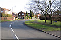
Top of Rawnsley Drive, Kenilworth
The junction ahead is with Thirlestane Close.
Image: © Robin Stott
Taken: 17 Jan 2010
0.14 miles