
IMAGES TAKEN NEAR TO
School Lane, KENILWORTH, CV8 2GS
Introduction
This page details the photographs taken nearby to School Lane, CV8 2GS by members of the Geograph project.
The Geograph project started in 2005 with the aim of publishing, organising and preserving representative images for every square kilometre of Great Britain, Ireland and the Isle of Man.

There are currently over 7.5m images from over14,400 individuals and you can help contribute to the project by visiting https://www.geograph.org.uk
Image Map
Images are licensed for reuse under creativecommons.org/licenses/by-sa/2.0
Notes
- Clicking on the map will re-center to the selected point.
- The higher the marker number, the further away the image location is from the centre of the postcode.
Image Listing (271 Images Found)
Images are licensed for reuse under creativecommons.org/licenses/by-sa/2.0
Image
Details
Distance
1
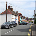
Kenilworth: School Lane
A sunny June morning was about to cloud over.
Image: © John Sutton
Taken: 4 Jun 2019
0.06 miles
2
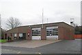
Kenilworth fire station
Kenilworth fire station, School Lane, Kenilworth, Warwickshire
Image: © Kevin Hale
Taken: 25 Nov 2006
0.06 miles
3
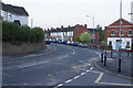
Hyde Road Junction
Central Kenilworth. This is quite dense housing for Kenilworth.
Image: © Malcolm Neal
Taken: 26 May 2017
0.08 miles
4
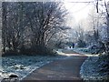
Frost on trees by Finham Brook
The shared footpath and cycleway leads from Manor Road to Abbey Fields and this section is behind houses in School Lane.
Image: © John Brightley
Taken: 7 Dec 2010
0.09 miles
5
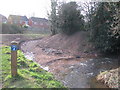
Overflow channel, Finham Brook
Looking upstream at the recently built overflow channel near School Lane. This is the second of 2 right-angle turns in a short distance on the brook, so the overflow effectively becomes a 'short-cut' when higher water levels are achieved.
Image: © E Gammie
Taken: 30 Jan 2008
0.09 miles
6
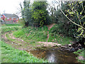
Overflow channel, Finham Brook
The overflow short-cuts a dog-leg on the Finham Brook. The past two years have seen less than average rainfalls so it's unlikely to have been in use recently.
More grass than in 2008 - http://www.geograph.org.uk/photo/673429
Image: © E Gammie
Taken: 16 Apr 2012
0.09 miles
7
Hyde Road at its junction with Albion Street
Image: © John Brightley
Taken: 17 Jul 2010
0.10 miles
8

Frost falling from tree - cycle path by Laurence Gardens
Note the frost falling from the tree as it is warmed slightly by the sunshine. The white on the ground is frost, not snow.
Image: © John Brightley
Taken: 7 Dec 2010
0.11 miles
9
1930's council houses, Albion Street
Image: © John Brightley
Taken: 10 Apr 2010
0.11 miles
10
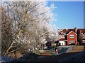
Frost at Laurence Gardens
The Finham Brook (also known as the Odibourne Brook) flows beneath the trees on the left. Occasionally after heavy rain the river level rises to the height of the footpath, and the houses are set above the flood level.
Image: © John Brightley
Taken: 7 Dec 2010
0.11 miles