
IMAGES TAKEN NEAR TO
New Street, KENILWORTH, CV8 2EZ
Introduction
This page details the photographs taken nearby to New Street, CV8 2EZ by members of the Geograph project.
The Geograph project started in 2005 with the aim of publishing, organising and preserving representative images for every square kilometre of Great Britain, Ireland and the Isle of Man.

There are currently over 7.5m images from over14,400 individuals and you can help contribute to the project by visiting https://www.geograph.org.uk
Image Map
Images are licensed for reuse under creativecommons.org/licenses/by-sa/2.0
Notes
- Clicking on the map will re-center to the selected point.
- The higher the marker number, the further away the image location is from the centre of the postcode.
Image Listing (225 Images Found)
Images are licensed for reuse under creativecommons.org/licenses/by-sa/2.0
Image
Details
Distance
1
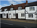
23 (part) & 25 New Street, Kenilworth
Most of no 23 to the left, and the whole of no 25 New Street, which date from the 17th century, or possibly earlier. They were collectively Grade II listed https://britishlistedbuildings.co.uk/101364893-23-and-25-new-street-kenilworth#.XVA1kuhKjcs & https://historicengland.org.uk/listing/the-list/list-entry/1364893 in 1971.
Image: © Richard Law
Taken: 27 Jun 2019
0.01 miles
2
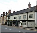
Kenilworth-The Royal Oak
Public House in New Street.
Image: © Ian Rob
Taken: 19 May 2016
0.01 miles
4
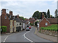
Kenilworth: New Street and The Royal Oak
Looking along the A429 road from Coventry towards the centre of Old Kenilworth.
Image: © John Sutton
Taken: 4 Jun 2019
0.02 miles
5
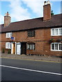
35 & 37 New Street, Kenilworth
The central pair of a row of terraced cottages, overall nos 33 - 39 New Street, which date from the 18th century. They were collectively Grade II listed https://britishlistedbuildings.co.uk/101183820-33-39-new-street-kenilworth#.XU3Kh-hKjcs & https://historicengland.org.uk/listing/the-list/list-entry/1183820 in 1971.
Image: © Richard Law
Taken: 27 Jun 2019
0.02 miles
6
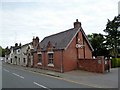
Kenilworth-The Cross
Public House on New Street.
Image: © Ian Rob
Taken: 19 May 2016
0.03 miles
8
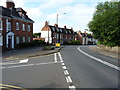
Houses at the junction of Manor Road with New Street
Image: © Richard Law
Taken: 27 Jun 2019
0.05 miles
9
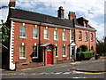
46 and 48 New Street, Kenilworth
46 (to the right) and 48 (on the left), on the corner of Manor Road. 48 is a listed building, and also its garden houses a gazebo which is listed in its own right - see Image]
Image: © John Brightley
Taken: 17 Jul 2010
0.05 miles
10
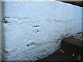
Nineteenth-century benchmark at 48 New Street
This bench mark was established during the First primary levelling of England & Wales between 1850 and 1856, and was levelled with a height of 268.1190 feet [81.7227 metres] above mean sea level (Liverpool datum). It was included on the Basingstoke to Coventry levelling line. The surveyor's description was "No. 238. Mark on corner of house at junction of roads, East end of Kenilworth ; 0.95 ft. above surface" (Public Abstract p.241).
Image: © Shantavira
Taken: 16 Jun 2015
0.06 miles