
IMAGES TAKEN NEAR TO
Southbank Road, KENILWORTH, CV8 1LA
Introduction
This page details the photographs taken nearby to Southbank Road, CV8 1LA by members of the Geograph project.
The Geograph project started in 2005 with the aim of publishing, organising and preserving representative images for every square kilometre of Great Britain, Ireland and the Isle of Man.

There are currently over 7.5m images from over14,400 individuals and you can help contribute to the project by visiting https://www.geograph.org.uk
Image Map
Images are licensed for reuse under creativecommons.org/licenses/by-sa/2.0
Notes
- Clicking on the map will re-center to the selected point.
- The higher the marker number, the further away the image location is from the centre of the postcode.
Image Listing (373 Images Found)
Images are licensed for reuse under creativecommons.org/licenses/by-sa/2.0
Image
Details
Distance
1
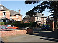
9 and 9a Southbank Road, Kenilworth
Seen from the forecourt of Wilton House.
Image: © John Brightley
Taken: 17 Apr 2010
0.01 miles
2
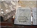
Wall coping, Wilton House, Southbank Road, Kenilworth
Wall to front forecourt.
Blue-brick coping with impressed stamp 'Stanley Bros. Midland Tile Works, Nuneaton'
Image: © John Brightley
Taken: 17 Apr 2010
0.02 miles
3
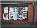
Posters on notice board, Wilton House, Kenilworth
Detail of building seen on Image]
Image: © John Brightley
Taken: 17 Apr 2010
0.02 miles
4
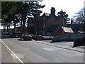
Wilton House, Southbank Road, Kenilworth
Originally the home of the Street family (see shared descriptions), and presently the offices of the town council and the local MP, Jeremy Wright. It is due to be demolished soon to make way for new apartments for the elderly.
Image: © John Brightley
Taken: 17 Apr 2010
0.02 miles
5
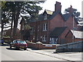
Wilton House, Southbank Road, Kenilworth
Image: © John Brightley
Taken: 17 Apr 2010
0.02 miles
6
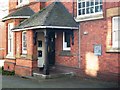
Porch detail, Wilton House, Southbank Road
Image: © John Brightley
Taken: 17 Apr 2010
0.02 miles
7
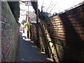
The Blundells, Kenilworth
The section of footpath that leads from Priory Road to Southbank Road.
The sandstone blocks at the base of the wall suggest that this may be an old boundary line and that the blocks were perhaps reclaimed in the 19th century from the Abbey ruins.
Image: © John Brightley
Taken: 17 Apr 2010
0.03 miles
8
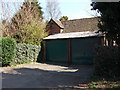
Old garage/ stable block, The Blundells, Kenilworth
Adjacent to 'Longacre', between Priory Road and Southbank Road.
Image: © John Brightley
Taken: 17 Apr 2010
0.03 miles
9
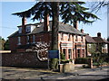
13-15 Southbank Road, Kenilworth
A pair of grand Victorian houses.
Image: © John Brightley
Taken: 17 Apr 2010
0.03 miles
10
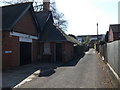
Driveway to the side of Wilton House, Southbank Road, Kenilworth
This driveway leads to the Senior Citizens Club and 18, 18a and 18b Southbank Road. All these properties are due to be demolished soon to make way for new retirement apartments.
Image: © John Brightley
Taken: 17 Apr 2010
0.03 miles