
IMAGES TAKEN NEAR TO
Beehive Hill, KENILWORTH, CV8 1BY
Introduction
This page details the photographs taken nearby to Beehive Hill, CV8 1BY by members of the Geograph project.
The Geograph project started in 2005 with the aim of publishing, organising and preserving representative images for every square kilometre of Great Britain, Ireland and the Isle of Man.

There are currently over 7.5m images from over14,400 individuals and you can help contribute to the project by visiting https://www.geograph.org.uk
Image Map
Images are licensed for reuse under creativecommons.org/licenses/by-sa/2.0
Notes
- Clicking on the map will re-center to the selected point.
- The higher the marker number, the further away the image location is from the centre of the postcode.
Image Listing (15 Images Found)
Images are licensed for reuse under creativecommons.org/licenses/by-sa/2.0
Image
Details
Distance
1
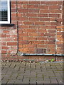
OS benchmark - Kenilworth, 37 Birmingham Road
An OS cutmark on the front of no 37; originally levelled in 1966 at 93.732m above Ordnance Datum Newlyn.
Image: © Richard Law
Taken: 27 Jun 2019
0.02 miles
3
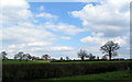
Farmland near Kenilworth
Looking toward Camp Farm from the bottom of Beehive Hill (A452).
Image: © E Gammie
Taken: 16 Apr 2012
0.13 miles
4
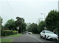
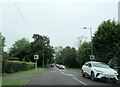
Clinton Lane Kenilworth near junction with the A452
Image: © Roy Hughes
Taken: 21 May 2024
0.16 miles
5
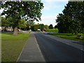
The A452 Beehive Hill at Kenilworth
Road junction on the northwest side of Kenilworth, where the A425 and the B4103 part ways.
Image: © Richard Law
Taken: 27 Jun 2019
0.17 miles
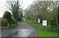
7
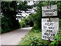
Chase Lane Kenilworth
These signs although quite old have been modified to state "No Right of Way for Motor Vehicles" I presume it once said No Through Road as in the sign above. The lane leads from the Birmingham road to Chase Farm and towards the Pleasaunce.
Image: © Nigel Mykura
Taken: 18 Jul 2010
0.20 miles
8
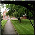
Presbytery of Church of St Augustine, Beehive Hill
The mid-19th century presbytery or priest's house was designed by Gilbert Blount, who enlarged the church around this time; see Image] and the Taking Stock site of Catholic church architecture https://taking-stock.org.uk/building/kennilworth-st-augustine/ .
Image: © A J Paxton
Taken: 10 Oct 2023
0.21 miles
9
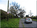
Birmingham Road near Kenilworth
The busy Birmingham Road, heading into Kenilworth. Two signs on the left, foremost an HS2 protest, further away directions to the castle.
Image: © E Gammie
Taken: 16 Apr 2012
0.23 miles
10
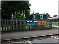
'Kids Club', St Augustine's School
A portacabin fitted in to a small space between the school and St Augustine's Church.
Image: © John Brightley
Taken: 17 Jul 2010
0.23 miles