IMAGES TAKEN NEAR TO
Horton Close, COVENTRY, CV7 9GB
Introduction
This page details the photographs taken nearby to Horton Close, CV7 9GB by members of the Geograph project.
The Geograph project started in 2005 with the aim of publishing, organising and preserving representative images for every square kilometre of Great Britain, Ireland and the Isle of Man.

There are currently over 7.5m images from over14,400 individuals and you can help contribute to the project by visiting https://www.geograph.org.uk
Image Map
Images are licensed for reuse under creativecommons.org/licenses/by-sa/2.0
Notes
- Clicking on the map will re-center to the selected point.
- The higher the marker number, the further away the image location is from the centre of the postcode.
Image Listing (11 Images Found)
Images are licensed for reuse under creativecommons.org/licenses/by-sa/2.0
Image
Details
Distance
1
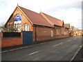
Exhall: The Old School now the Community Centre
The old school, now a community centre, is on the west side of Exhall Green road. The small white roundel in the gable end facing the road records that The Bedworth Society gave the building an award in 2002 for "Outstanding environmental improvement".
Image: © Nigel Cox
Taken: 31 Dec 2011
0.03 miles
2
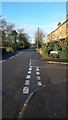
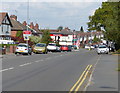
School Lane Exhall
School Road is captured here at its junction with Bruce Road in Exhall, on the outskirts of Bedworth.
Image: © Peter Mackenzie
Taken: 28 Jan 2017
0.11 miles
3
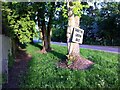
NIMBY tree, School Lane, Exhall
NIMBY = Not In My Back Yard. There are a number of such signs by the roadside in Exhall protesting against the proposed development of housing or industrial units on the green belt around towns and cities that is supposedly preserved from building. This is an 'edgeland' district on the fringe of the built-up area, with many small pieces of countryside hemmed in by roads, housing and other developments. They are valued by local people, but also an obvious place for developers to build on and for planners to sacrifice rather than allow building on open countryside.
Image: © A J Paxton
Taken: 30 May 2021
0.15 miles
5
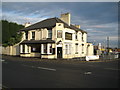
Exhall: The Lord Raglan
Judging by the state of the car park and the back yard the Raggy on the B4113 Coventry Road appears to now be closed.
Image: © Nigel Cox
Taken: 31 Dec 2011
0.19 miles
6
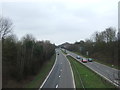
The A444 northbound, Bedworth
Looking north east from the bridge on School Lane.
Image: © JThomas
Taken: 11 Mar 2017
0.21 miles
7
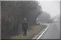
Nuneaton and Bedworth : A444 Roadside
Looking along the roadside of the A444 with a woman walking.
Image: © Lewis Clarke
Taken: 6 Feb 2012
0.21 miles
8
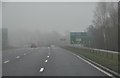
Nuneaton and Bedworth : A444 Road
The A444 approaching the roundabout and motorway junction.
Image: © Lewis Clarke
Taken: 6 Feb 2012
0.23 miles
9
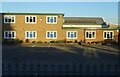
Commercial Premises
There's nothong to indicate what sort of activity is carried on in this building.
Image: © Anne Burgess
Taken: 23 Sep 2021
0.24 miles