
IMAGES TAKEN NEAR TO
McDonnell Drive, COVENTRY, CV7 9GA
Introduction
This page details the photographs taken nearby to McDonnell Drive, CV7 9GA by members of the Geograph project.
The Geograph project started in 2005 with the aim of publishing, organising and preserving representative images for every square kilometre of Great Britain, Ireland and the Isle of Man.

There are currently over 7.5m images from over14,400 individuals and you can help contribute to the project by visiting https://www.geograph.org.uk
Image Map
Images are licensed for reuse under creativecommons.org/licenses/by-sa/2.0
Notes
- Clicking on the map will re-center to the selected point.
- The higher the marker number, the further away the image location is from the centre of the postcode.
Image Listing (11 Images Found)
Images are licensed for reuse under creativecommons.org/licenses/by-sa/2.0
Image
Details
Distance
1
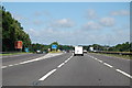
M6 westbound at Junction 3
Exit for A444.
Image: © J. Hannan-Briggs
Taken: 18 Jul 2015
0.05 miles
2
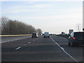
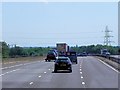
M6 Motorway, Southbound At Junction 3
Image: © Peter Whatley
Taken: 28 Dec 2009
0.06 miles
3
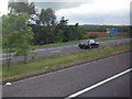
M6 northbound exit slip road at Junction 3
Image: © Colin Pyle
Taken: 13 May 2011
0.09 miles
4
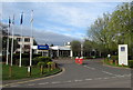
Entrance to Novotel, Coventry
Hotel entrance from Wilson's Lane, near M6 motorway junction 3.
Image: © Jaggery
Taken: 19 Apr 2015
0.16 miles
5
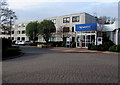
Novotel, Coventry
Hotel in Wilson's Lane, near M6 motorway junction 3.
Image: © Jaggery
Taken: 19 Apr 2015
0.16 miles
7
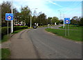
Weight limit ahead, Wilson's Lane, Coventry
Signs show a 7.5 tonnes vehicle weight limit ½ mile ahead.
The entrance to Novotel Coventry http://www.geograph.org.uk/photo/4437880 is a few tens of metres behind the parked car.
Image: © Jaggery
Taken: 19 Apr 2015
0.21 miles
9
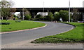
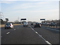
M6 motorway flyover, Exhall
The motorway crosses above the B4113 near junction 3.
Exhall is a suburb in the Nuneaton and Bedworth district of Warwickshire.
Image: © Jaggery
Taken: 19 Apr 2015
0.22 miles
10
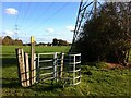
Redundant kissing gate
The hedge through which the gate provided a way has been removed, although isolated hawthorn trees remain. The footpath runs through a triangle of farmland hemmed in by roads and housing.
Image: © A J Paxton
Taken: 22 Oct 2020
0.23 miles