
IMAGES TAKEN NEAR TO
Blackhorse Road, COVENTRY, CV7 9FW
Introduction
This page details the photographs taken nearby to Blackhorse Road, CV7 9FW by members of the Geograph project.
The Geograph project started in 2005 with the aim of publishing, organising and preserving representative images for every square kilometre of Great Britain, Ireland and the Isle of Man.

There are currently over 7.5m images from over14,400 individuals and you can help contribute to the project by visiting https://www.geograph.org.uk
Image Map
Images are licensed for reuse under creativecommons.org/licenses/by-sa/2.0
Notes
- Clicking on the map will re-center to the selected point.
- The higher the marker number, the further away the image location is from the centre of the postcode.
Image Listing (20 Images Found)
Images are licensed for reuse under creativecommons.org/licenses/by-sa/2.0
Image
Details
Distance
2
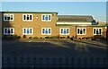
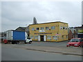
Commercial Premises
There's nothong to indicate what sort of activity is carried on in this building.
Image: © Anne Burgess
Taken: 23 Sep 2021
0.09 miles
3
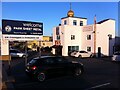
Gurdwara (Sikh temple), Bayton Road, Bedworth
Gurdwara on the Bayton Road industrial estate, in among the sheet metal and plastics factories. There is another gurdwara almost opposite, a modest single-storey building unadorned by a dome. The one photographed is called Gurdwara Baba Vadbhag Singh Ji.
Image: © A J Paxton
Taken: 30 May 2021
0.12 miles
4
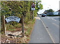
Black Horse Road in Hawkesbury Village
Image: © Mat Fascione
Taken: 28 Sep 2014
0.12 miles
6
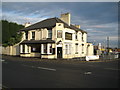
Exhall: The Lord Raglan
Judging by the state of the car park and the back yard the Raggy on the B4113 Coventry Road appears to now be closed.
Image: © Nigel Cox
Taken: 31 Dec 2011
0.16 miles
7
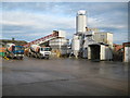
Exhall: Hanson Premix ready mixed concrete plant
The ready mixed concrete plant is on Bryant Road in the Bayton Road industrial estate.
Image: © Nigel Cox
Taken: 31 Dec 2011
0.17 miles
8
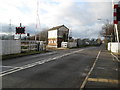
Hawkesbury: Black Horse Road level crossing
The London & North Western Railway built their branch line connecting Coventry with Nuneaton across here in 1850. The line was closed to passenger traffic in 1965, but opened again in 1987. It currently has a single coach hourly service, but funding was put in place in 2011 to upgrade the line with two new stations, one of which is planned to be next to Coventry City's Ricoh Stadium.
The old signal box, built in 1896, was made redundant with signalling improvements in 2009 and is currently boarded up. The site of the former Hawkesbury Lane railway station, which closed in 1965 and did not reopen in 1987, is just up the track on the right from the level crossing.
Image: © Nigel Cox
Taken: 31 Dec 2011
0.18 miles
9
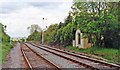
Site of Hawkesbury Lane station, 1995
View NE, towards Nuneaton: ex-LNWR Nuneaton - Coventry line. Although an important link between the London Euston - Birmingham main line through Coventry and the West Coast Main Line through Nuneaton, even this line was closed to passengers from 18/1/65 but was restored from 14/5/88 although not Hawkesbury Lane station itself. (Cf. Image]).
Image: © Ben Brooksbank
Taken: 29 May 1995
0.19 miles
10
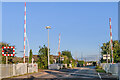
Black Horse Road Level Crossing
Level crossing on the Coventry - Nuneaton railway. Beyond the barriers on the left is the former Hawkesbury Lane Station stationmaster's house (see Image).
Image: © Ian Capper
Taken: 23 Sep 2021
0.19 miles