IMAGES TAKEN NEAR TO
Howat Road, COVENTRY, CV7 8JN
Introduction
This page details the photographs taken nearby to Howat Road, CV7 8JN by members of the Geograph project.
The Geograph project started in 2005 with the aim of publishing, organising and preserving representative images for every square kilometre of Great Britain, Ireland and the Isle of Man.

There are currently over 7.5m images from over14,400 individuals and you can help contribute to the project by visiting https://www.geograph.org.uk
Image Map
Images are licensed for reuse under creativecommons.org/licenses/by-sa/2.0
Notes
- Clicking on the map will re-center to the selected point.
- The higher the marker number, the further away the image location is from the centre of the postcode.
Image Listing (30 Images Found)
Images are licensed for reuse under creativecommons.org/licenses/by-sa/2.0
Image
Details
Distance
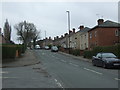
2
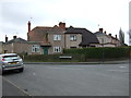
Bennetts Road North, Keresley
At the corner of Howat Road
Image: © David Howard
Taken: 21 May 2023
0.12 miles
3
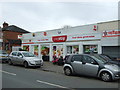
Post Office and stores on Bennett's Road North, Keresley
Image: © JThomas
Taken: 11 Mar 2017
0.12 miles
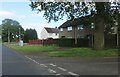
4
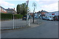
Bennetts Road North, Keresley
At the end of Howat Road
Image: © David Howard
Taken: 21 May 2023
0.13 miles
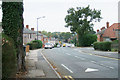
5
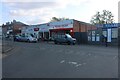
Bennett's Road North, Keresley
Looking south.
Image: © JThomas
Taken: 11 Mar 2017
0.13 miles
8
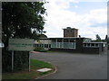
Keresley Newland Primary School
A 1950s style building near the southern edge of the square.
Image: © David Stowell
Taken: 27 Aug 2006
0.14 miles
9
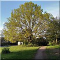
Oak tree by Exhall Road, Keresley
The tree stands on a green, next to a sign welcoming travellers to Nuneaton & Bedworth borough.
Image: © A J Paxton
Taken: 30 Apr 2024
0.15 miles
10
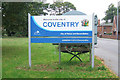
Local Authority Boundary Sign, Keresley Village
Keresley village is part of the City of Coventry, unlike most of the surrounding area which falls under the Borough of Nuneaton and Bedworth. This sign is only a few years old, as it displays the logo and livery adopted by Coventry City Council around 2004. The strapline 'City of Peace and Reconciliation' has been in use for many years, reflecting a long-held civic mission of the city.
Image: © Niki Walton
Taken: 12 Oct 2007
0.16 miles