
IMAGES TAKEN NEAR TO
Hill Top, COVENTRY, CV7 8GA
Introduction
This page details the photographs taken nearby to Hill Top, CV7 8GA by members of the Geograph project.
The Geograph project started in 2005 with the aim of publishing, organising and preserving representative images for every square kilometre of Great Britain, Ireland and the Isle of Man.

There are currently over 7.5m images from over14,400 individuals and you can help contribute to the project by visiting https://www.geograph.org.uk
Image Map
Images are licensed for reuse under creativecommons.org/licenses/by-sa/2.0
Notes
- Clicking on the map will re-center to the selected point.
- The higher the marker number, the further away the image location is from the centre of the postcode.
Image Listing (5 Images Found)
Images are licensed for reuse under creativecommons.org/licenses/by-sa/2.0
Image
Details
Distance
1
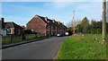
Hill Top
A view of some houses in this rural hamlet.
Image: © Peter Mackenzie
Taken: 30 Oct 2017
0.02 miles
2
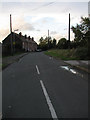
Hill Top at dusk
A view of Hill Top (formerly part of New Arley). One of the houses in the row used to be the Police House for Arley, where the Neighbourhood Watch met and the Community Police officers could meet their err.. community!
Image: © Richard Harrison
Taken: 28 Oct 2005
0.02 miles
3
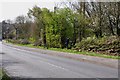
Hedge Laying the old fashioned way at Hill Top
The gentleman almost hidden in the centre of the picture, is doing an outstanding job , laying this very overgrown hedge, the way it has been done for hundreds of years, not just chopping it off with a chainsaw.
Image: © Mick Malpass
Taken: 1 Apr 2012
0.05 miles
4
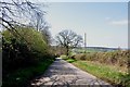
Leaving Gun Hill on Church Lane
In the distance across the valley, Old Arley can just be seen behind the telegraph pole.
Image: © Mick Malpass
Taken: 1 Apr 2012
0.24 miles
5
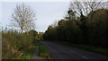
Heading towards Ansley
The minor road south of Ansley.
Image: © Peter Mackenzie
Taken: 30 Oct 2017
0.25 miles