
IMAGES TAKEN NEAR TO
Tamworth Road, COVENTRY, CV7 8BP
Introduction
This page details the photographs taken nearby to Tamworth Road, CV7 8BP by members of the Geograph project.
The Geograph project started in 2005 with the aim of publishing, organising and preserving representative images for every square kilometre of Great Britain, Ireland and the Isle of Man.

There are currently over 7.5m images from over14,400 individuals and you can help contribute to the project by visiting https://www.geograph.org.uk
Image Map
Images are licensed for reuse under creativecommons.org/licenses/by-sa/2.0
Notes
- Clicking on the map will re-center to the selected point.
- The higher the marker number, the further away the image location is from the centre of the postcode.
Image Listing (11 Images Found)
Images are licensed for reuse under creativecommons.org/licenses/by-sa/2.0
Image
Details
Distance
1
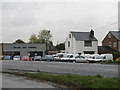
Corley Ash Motors fixers of poorly crash-ed motors!
Just opposite the Saracen's Head public house.
Image: © Richard Harrison
Taken: 26 Oct 2005
0.03 miles
2

Corley Ash Garage with ash tree
The garage stands in the hamlet of Corley Ash, at the junction of Square Lane, Highfield Lane and Tamworth Road. The dropped 'Enron E' is a nice touch.
Image: © A J Paxton
Taken: 15 Jul 2021
0.03 miles
3
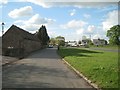
Lay-by beside the B4098 Tamworth Road, nearing Corley Ash
Image: © Robin Stott
Taken: 15 May 2013
0.04 miles
4
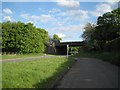
M6 motorway crosses the B4098 Tamworth Road, Corley Ash
The view is from a lay-by north of the motorway overbridge.
Image: © Robin Stott
Taken: 15 May 2013
0.13 miles
5
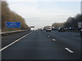
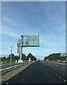
M6 Motorway - 1 Mile To Corley Services
Image: © Peter Whatley
Taken: 28 Dec 2009
0.13 miles
7
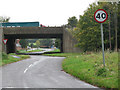
The M6 at Corley
A few years ago a lorry crashed off the M6 here onto the road below...makes you realise how life can catch you unawares!
Image: © Richard Harrison
Taken: 26 Oct 2005
0.16 miles
9
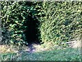
Into the woods by Red Hill Farm
The footpath, which is part of the Coventry Way, enters the wood through this arch of foliage. There is a small bench to the right, offering a view across a meadow. The wood appears to be of recent origin; it is not marked on OS maps as late as the 1950s.
Image: © A J Paxton
Taken: 6 Sep 2021
0.22 miles
10
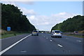
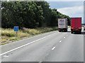
M6 westbound near Corley
At Marker 161.0
Image: © J. Hannan-Briggs
Taken: 18 Jul 2015
0.22 miles