
IMAGES TAKEN NEAR TO
Hampton Grange, COVENTRY, CV7 7RU
Introduction
This page details the photographs taken nearby to Hampton Grange, CV7 7RU by members of the Geograph project.
The Geograph project started in 2005 with the aim of publishing, organising and preserving representative images for every square kilometre of Great Britain, Ireland and the Isle of Man.

There are currently over 7.5m images from over14,400 individuals and you can help contribute to the project by visiting https://www.geograph.org.uk
Image Map
Images are licensed for reuse under creativecommons.org/licenses/by-sa/2.0
Notes
- Clicking on the map will re-center to the selected point.
- The higher the marker number, the further away the image location is from the centre of the postcode.
Image Listing (62 Images Found)
Images are licensed for reuse under creativecommons.org/licenses/by-sa/2.0
Image
Details
Distance
1
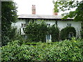
The Laurels House, Meriden
In need of a little 'gardening' it could be argued, but nonetheless a rather fine mid 19th century villa which was Grade II listed https://britishlistedbuildings.co.uk/101342857-the-laurels-meriden#.XaNh7ehKjIU & v in 1976.
Image: © Richard Law
Taken: 22 Aug 2019
0.04 miles
3

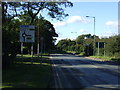
The centre of England?
Meriden has long claimed to be the centre of England. Other candidates are listed by Alan Walker at Image
Image: © Robin Stott
Taken: 15 Aug 2011
0.06 miles
4

Caravan storage, Birmingham Road
It includes the odd boat. In France they call this 'un garage mort'.
Image: © Robin Stott
Taken: 15 Aug 2011
0.08 miles

7
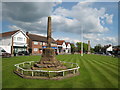
Meriden Village Green
The centre of Meriden, along with the ancient cross marking one of several sites claiming to be the "Centre of England". Beyond the village maypole is the monument erected to commemorate cyclists who lost their lives during the Great War .
Image: © David Stowell
Taken: 19 May 2007
0.10 miles
8

Road junction west of Meriden
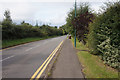
Left of centre the realigned Maxstoke Lane to and from the A45 joins Birmingham Road. Modern roads give the village of Meriden some relief from agricultural and quarry traffic.
Image: © Robin Stott
Taken: 15 Aug 2011
0.10 miles
9
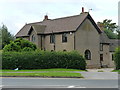
Corner House, Meriden
Dating from the early 19th century, and quite distinctive in its roughcast render coating. It was Grade II listed https://britishlistedbuildings.co.uk/101076747-corner-house-meriden#.XaNhBOhKjIU & https://historicengland.org.uk/listing/the-list/list-entry/1076747 in 1976.
Image: © Richard Law
Taken: 22 Aug 2019
0.10 miles
10
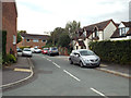
Maxstoke Close off Maxstoke Lane, Meriden
A pleasant mix of old and new though small plots and many cars mean a clogged Close and obstructed footways.
Image: © Robin Stott
Taken: 21 Sep 2014
0.11 miles