
IMAGES TAKEN NEAR TO
Balsall Street, COVENTRY, CV7 7PJ
Introduction
This page details the photographs taken nearby to Balsall Street, CV7 7PJ by members of the Geograph project.
The Geograph project started in 2005 with the aim of publishing, organising and preserving representative images for every square kilometre of Great Britain, Ireland and the Isle of Man.

There are currently over 7.5m images from over14,400 individuals and you can help contribute to the project by visiting https://www.geograph.org.uk
Image Map
Images are licensed for reuse under creativecommons.org/licenses/by-sa/2.0
Notes
- Clicking on the map will re-center to the selected point.
- The higher the marker number, the further away the image location is from the centre of the postcode.
Image Listing (21 Images Found)
Images are licensed for reuse under creativecommons.org/licenses/by-sa/2.0
Image
Details
Distance
2
Balsall Common-Hobbe Cottage
On Balsall Street.
Image: © Ian Rob
Taken: 10 Aug 2021
0.04 miles
3
Shenstone Drive
A leafy cul-de-sac off the south end of Shenstone Drive.
Image: © Robin Stott
Taken: 11 Aug 2010
0.04 miles
4
Hobbe Cottage, Balsall Street
Probably late 16th or early 17th century, and given a Grade II listing https://www.britishlistedbuildings.co.uk/101075980-hobbe-cottage-balsall#.Wbg-sdQrLGg in 1972.
Image: © Richard Law
Taken: 22 Aug 2017
0.04 miles
5
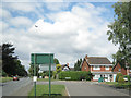
Balsall Street - under the flightpath
Balsall Street left and foreground, at the junction with Shenstone Drive. The black and white gable belongs to Shenstone Grange, a Grade II listed building. Outwardly Edwardian, it encapsulates a nationally significant 17th-century timber-framed house. It is home to the Island Project, a charity providing education for autistic children. http://www.theislandproject.co.uk http://www.britishlistedbuildings.co.uk/en-495898-shenstone-grange-balsall
Image: © Robin Stott
Taken: 11 Aug 2010
0.07 miles
6
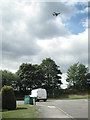
Shenstone Drive meets Balsall Street
The area is close to the flightpath into Birmingham Airport. On a weekday morning planes were going over every few minutes.
Image: © Robin Stott
Taken: 11 Aug 2010
0.07 miles
7
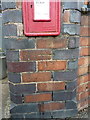
OS benchmark - Balsall Street, letterbox
An OS cutmark on a brick-mounted letterbox at the junction of Balsall Street with Station Road. It was originally levelled, probably in 1966, at 116.600m above Ordnance Datum Newlyn.
Image: © Richard Law
Taken: 22 Aug 2017
0.07 miles
8

Station Road meets Balsall Street
The station is Berkswell Image The postbox number is CV7 63. The building on the left bears a plaque 'Blacksmith's Corner' and is the premises of Capitax. Neighbouring small businesses are Direct Carpets and Woodrow Framing.
Image: © Robin Stott
Taken: 11 Aug 2010
0.07 miles
9
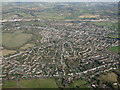
HS2 construction near Balsall Common from the air
Looking along Station Road, the line of the HS2 works can be seen in the distance. Viewed from a Birmingham bound flight from Prague.
Image: © Thomas Nugent
Taken: 11 Feb 2022
0.09 miles
10
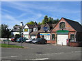
Blacksmith's Corner
These buildings are now used for somewhat higher-tech. purposes. The junction of Station Road with the road from Knowle.
Image: © David Stowell
Taken: 21 Aug 2005
0.09 miles