IMAGES TAKEN NEAR TO
Coventry Road, COVENTRY, CV7 7AZ
Introduction
This page details the photographs taken nearby to Coventry Road, CV7 7AZ by members of the Geograph project.
The Geograph project started in 2005 with the aim of publishing, organising and preserving representative images for every square kilometre of Great Britain, Ireland and the Isle of Man.

There are currently over 7.5m images from over14,400 individuals and you can help contribute to the project by visiting https://www.geograph.org.uk
Image Map
Images are licensed for reuse under creativecommons.org/licenses/by-sa/2.0
Notes
- Clicking on the map will re-center to the selected point.
- The higher the marker number, the further away the image location is from the centre of the postcode.
Image Listing (20 Images Found)
Images are licensed for reuse under creativecommons.org/licenses/by-sa/2.0
Image
Details
Distance
1
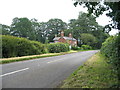
Cottage on Coventry Road
A cottage at the entrance to Hill House Farm on Coventry Road (Broad Lane). It looks to be 19th century with a later extension to the right. A for sale sign stands outside.
A closer view in 2005: http://www.geograph.org.uk/photo/45948
Image: © E Gammie
Taken: 8 Jul 2012
0.00 miles
2
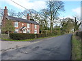
Hill Cottage or Hill House Cottage
Recorded by the OS as 'Hill Cottage' when they cut a benchmark into the NW face in the mid 1960s, the name appears to have changed to Hill House Cottage Image in more recent years.
Image: © Richard Law
Taken: 20 Feb 2018
0.00 miles
3
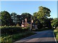
Hill House Lodge & Drive, Coventry Road, Berkswell
The Coventry Way here follows a short stretch of road before continuing off to the left by the lodge, following the drive of Hill House Farm, the former Hill House.
Image: © A J Paxton
Taken: 8 Jun 2024
0.01 miles
4
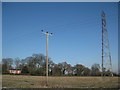
Disused Pylon
Next to the small low voltage pole was an old high voltage pylon that no longer carried powerlines. In the background is one of the houses on Broad Lane which runs from Berkswell to Upper Eastern Green.
Image: © Nigel Mykura
Taken: 11 Feb 2012
0.03 miles
5
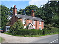
Estate House in Coventry Road/
This is Hill House Cottage, dating from 1857 according to the inscription above the porch and it sits at the start of the driveway to Hill House Farm. (Thanks to Robin Stott for additional information.)
Image: © David Stowell
Taken: 29 Aug 2005
0.04 miles
6
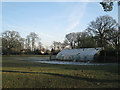
Greenhouse north of Hill House Cottage
Was the shaded location intentional, for a particular crop, or was it the only site that could be found?
Image: © Robin Stott
Taken: 21 Jan 2011
0.04 miles
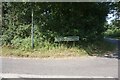
8
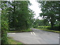
Benton Green Lane and Coventry Road
The junction of Benton Green Lane with Coventry Road, looking towards Berkswell. The road here forms part of the Coventry Way path.
Image: © E Gammie
Taken: 8 Jul 2012
0.06 miles
9

Amalgamated fields near Hill House Farm
A row of oaks in the middle of a field is a sign that a hedge has been removed.
Image: © Robin Stott
Taken: 21 Jan 2011
0.09 miles